Chahe geodata
Chahe (Jiangsu) is a seat of a fourth-order administrative division; located in China in Asia/Shanghai (GMT+8) time zone. In our database, there are 1268 cities with bigger population. Compared to other cities in China, 63.3% of cities are located further ↓South; 87.4% of cities are located further ←West and 94.3% of cities have higher elevation than Chahe. Note1


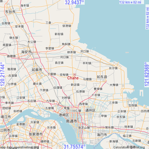
Chahe GPS coordinates[2]
32° 21' 6.012" North, 120° 55' 14.016" East
| Map corner | latitude | longitude |
|---|---|---|
| Upper-left | 32.9437°, | 120.21744° |
| Center: | 32.35167°, | 120.92056° |
| Lower-right: | 31.75574°, | 121.62369° |
| Map W x H: | 132.1×132.1 km | = 82.1×82.1mi |
| max Lat: | 53.31946° ⇑36.7% North |
| Chahe: | 32.35167° |
| min Lat: | ⇓63.3% South 18.22056° |
| min Long | Chahe | max Long |
| 75.07348° | 120.92056° | 134.28917° |
| W 87.4%⇐ | ⇒12.6% E |
Elevation
Elevation of Chahe is 7 m = 23 ft, and this is 477.8 m = 1568 ft below average elevation for this country.
| Max E: |
5622 m = 18445 ft | 94.3% |
| Avg. | 484.8 m = 1591 ft | |
| Chahe | 7 m = 23 ft | |
Min E: |
-3 m = -10 ft | 5.7% |
See also: China elevation on elevation.city.
Geographical zone
Chahe is located in North temperate zone (between Tropic of Cancer and the Arctic Circle). Distance of this Northern Tropic circle is 991.2 km =615.9 mi to South.| Distance of | km | miles | from Chahe |
|---|---|---|---|
| North Pole | 6409.9 | 3982.9 | to North |
| Arctic Circle | 3804 | 2363.7 | to North |
| Tropic Cancer | 991.2 | 615.9 | to South |
| Equator | 3597.2 | 2235.2 | to South |


Nearby cities:
15 places around Chahe: (largest is in red/bold)
• Baipu
19.7 km =12.2 mi,  232°
232°
• Bingcha
19.2 km =11.9 mi,  351°
351°
• Caobu
19.4 km =12.1 mi,  125°
125°
• Dingyan
19.8 km =12.3 mi,  273°
273°
• Fengli
15.7 km =9.8 mi,  47°
47°
• Hekou
18.1 km =11.2 mi,  329°
329°
• Linzi
17.9 km =11.1 mi,  250°
250°
• Matang
11.5 km =7.1 mi,  107°
107°
• Shigang
15.6 km =9.7 mi,  160°
160°
• Shuangdian
9.4 km =5.8 mi, 270°
• Xiamazhuang
20.2 km =12.6 mi,  7°
7°
• Xindian
8.9 km =5.5 mi,  178°
178°
• Xujia Changzhuang
17.3 km =10.7 mi,  58°
58°
• Yuanzhuang
17.5 km =10.9 mi,  307°
307°
• Zhangjiayuan
19.7 km =12.2 mi, 54°
Sources, notices
• [Note1] Compared only with cities in China existing in our database
• [Src1] Map data: © OpenStreetMap contributors (CC-BY-SA)
• [Src2] Other city data from geonames.org with taken over terms of usage.
• [Src3] Geographical zone / Annual Mean Temperature by Robert A. Rohde @ Wikipedia
