Caobu geodata
Caobu (Jiangsu) is a seat of a fourth-order administrative division; located in China in Asia/Shanghai (GMT+8) time zone. In our database, there are 1268 cities with bigger population. Compared to other cities in China, 62.7% of cities are located further ↓South; 88.1% of cities are located further ←West and 95.9% of cities have higher elevation than Caobu. Note1


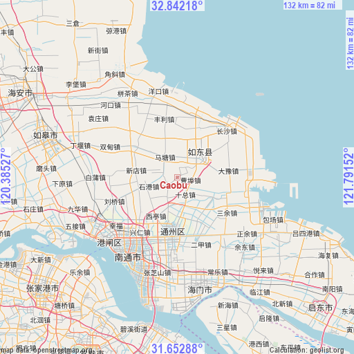
Caobu GPS coordinates[2]
32° 14' 58.128" North, 121° 5' 18.204" East
| Map corner | latitude | longitude |
|---|---|---|
| Upper-left | 32.84218°, | 120.38527° |
| Center: | 32.24948°, | 121.08839° |
| Lower-right: | 31.65288°, | 121.79152° |
| Map W x H: | 132.2×132.2 km | = 82.1×82.1mi |
| max Lat: | 53.31946° ⇑37.3% North |
| Caobu: | 32.24948° |
| min Lat: | ⇓62.7% South 18.22056° |
| min Long | Caobu | max Long |
| 75.07348° | 121.08839° | 134.28917° |
| W 88.1%⇐ | ⇒11.9% E |
Elevation
Elevation of Caobu is 6 m = 20 ft, and this is 478.8 m = 1571 ft below average elevation for this country.
| Max E: |
5622 m = 18445 ft | 95.9% |
| Avg. | 484.8 m = 1591 ft | |
| Caobu | 6 m = 20 ft | |
Min E: |
-3 m = -10 ft | 4.1% |
See also: China elevation on elevation.city.
Geographical zone
Caobu is located in North temperate zone (between Tropic of Cancer and the Arctic Circle). Distance of this Northern Tropic circle is 979.9 km =608.9 mi to South.| Distance of | km | miles | from Caobu |
|---|---|---|---|
| North Pole | 6421.3 | 3990 | to North |
| Arctic Circle | 3815.4 | 2370.8 | to North |
| Tropic Cancer | 979.9 | 608.9 | to South |
| Equator | 3585.8 | 2228.1 | to South |


Nearby cities:
15 places around Caobu: (largest is in red/bold)
• Bingfang
19.6 km =12.2 mi,  83°
83°
• Chahe
19.4 km =12.1 mi,  305°
305°
• Dayu
20.7 km =12.9 mi,  70°
70°
• Dongshe
19.1 km =11.9 mi,  152°
152°
• Jinsha
17.8 km =11.1 mi,  184°
184°
• Juegang
11.8 km =7.3 mi,  50°
50°
• Matang
9.3 km =5.8 mi,  328°
328°
• Qi’an
8.8 km =5.5 mi,  204°
204°
• Shigang
11.2 km =7 mi,  252°
252°
• Shizong
7 km =4.3 mi, 153°
• Si’an
18.7 km =11.6 mi,  227°
227°
• Wujia
15.5 km =9.6 mi,  137°
137°
• Xindian
15.7 km =9.8 mi,  279°
279°
• Xiting
16.6 km =10.3 mi,  208°
208°
• Xujia Changzhuang
20.3 km =12.6 mi,  357°
357°
Sources, notices
• [Note1] Compared only with cities in China existing in our database
• [Src1] Map data: © OpenStreetMap contributors (CC-BY-SA)
• [Src2] Other city data from geonames.org with taken over terms of usage.
• [Src3] Geographical zone / Annual Mean Temperature by Robert A. Rohde @ Wikipedia
