Canzhuang geodata
Canzhuang (Shandong) is a seat of a fourth-order administrative division; located in China in Asia/Shanghai (GMT+8) time zone. In our database, there are 1268 cities with bigger population. Compared to other cities in China, 80% of cities are located further ↓South; 83.2% of cities are located further ←West and 66.4% of cities have higher elevation than Canzhuang. Note1


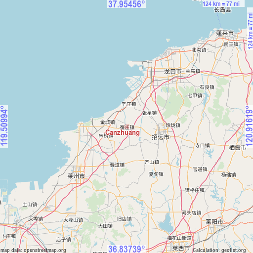
Canzhuang GPS coordinates[2]
37° 23' 53.016" North, 120° 12' 47.016" East
| Map corner | latitude | longitude |
|---|---|---|
| Upper-left | 37.95456°, | 119.50994° |
| Center: | 37.39806°, | 120.21306° |
| Lower-right: | 36.83739°, | 120.91619° |
| Map W x H: | 124.2×124.2 km | = 77.2×77.2mi |
| max Lat: | 53.31946° ⇑20% North |
| Canzhuang: | 37.39806° |
| min Lat: | ⇓80% South 18.22056° |
| min Long | Canzhuang | max Long |
| 75.07348° | 120.21306° | 134.28917° |
| W 83.2%⇐ | ⇒16.8% E |
Elevation
Elevation of Canzhuang is 67 m = 220 ft, and this is 417.8 m = 1371 ft below average elevation for this country.
| Max E: |
5622 m = 18445 ft | 66.4% |
| Avg. | 484.8 m = 1591 ft | |
| Canzhuang | 67 m = 220 ft | |
Min E: |
-3 m = -10 ft | 33.6% |
See also: China elevation on elevation.city.
Geographical zone
Canzhuang is located in North temperate zone (between Tropic of Cancer and the Arctic Circle). Distance of this Northern Tropic circle is 1552.4 km =964.6 mi to South.| Distance of | km | miles | from Canzhuang |
|---|---|---|---|
| North Pole | 5848.8 | 3634.3 | to North |
| Arctic Circle | 3242.9 | 2015 | to North |
| Tropic Cancer | 1552.4 | 964.6 | to South |
| Equator | 4158.3 | 2583.8 | to South |


Nearby cities:
15 places around Canzhuang: (largest is in red/bold)
• Chengguo
27.7 km =17.2 mi,  225°
225°
• Daqinjia
22 km =13.7 mi,  101°
101°
• Huangshanguan
17.1 km =10.6 mi,  18°
18°
• Jincheng
9.8 km =6.1 mi,  284°
284°
• Jinling
7.4 km =4.6 mi,  89°
89°
• Linglong
22.8 km =14.2 mi, 87°
• Pinglidian
20.8 km =12.9 mi, 234°
• Qicai
21.1 km =13.1 mi,  144°
144°
• Sanshandao
23 km =14.3 mi,  271°
271°
• Xiadian
27.4 km =17 mi,  147°
147°
• Xinzhuang
11.5 km =7.1 mi,  5°
5°
• Yidao
19.1 km =11.9 mi,  193°
193°
• Zhangxing
13.2 km =8.2 mi,  58°
58°
• Zhaoyuan
17.8 km =11.1 mi, 101°
• Zhuqiao
11 km =6.8 mi,  249°
249°
Sources, notices
• [Note1] Compared only with cities in China existing in our database
• [Src1] Map data: © OpenStreetMap contributors (CC-BY-SA)
• [Src2] Other city data from geonames.org with taken over terms of usage.
• [Src3] Geographical zone / Annual Mean Temperature by Robert A. Rohde @ Wikipedia
