Qicai geodata
Qicai (Shandong) is a seat of a fourth-order administrative division; located in China in Asia/Shanghai (GMT+8) time zone. In our database, there are 1268 cities with bigger population. Compared to other cities in China, 79.7% of cities are located further ↓South; 84.3% of cities are located further ←West and 53.4% of cities have higher elevation than Qicai. Note1


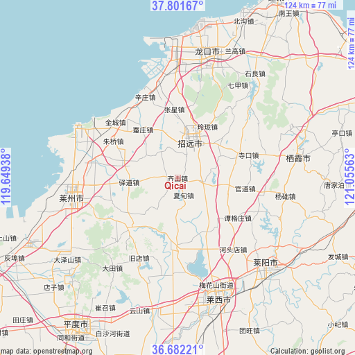
Qicai GPS coordinates[2]
37° 14' 38.472" North, 120° 21' 9" East
| Map corner | latitude | longitude |
|---|---|---|
| Upper-left | 37.80167°, | 119.64938° |
| Center: | 37.24402°, | 120.3525° |
| Lower-right: | 36.68221°, | 121.05563° |
| Map W x H: | 124.5×124.5 km | = 77.4×77.4mi |
| max Lat: | 53.31946° ⇑20.3% North |
| Qicai: | 37.24402° |
| min Lat: | ⇓79.7% South 18.22056° |
| min Long | Qicai | max Long |
| 75.07348° | 120.3525° | 134.28917° |
| W 84.3%⇐ | ⇒15.7% E |
Elevation
Elevation of Qicai is 141 m = 463 ft, and this is 343.8 m = 1128 ft below average elevation for this country.
| Max E: |
5622 m = 18445 ft | 53.4% |
| Avg. | 484.8 m = 1591 ft | |
| Qicai | 141 m = 463 ft | |
Min E: |
-3 m = -10 ft | 46.6% |
See also: China elevation on elevation.city.
Geographical zone
Qicai is located in North temperate zone (between Tropic of Cancer and the Arctic Circle). Distance of this Northern Tropic circle is 1535.2 km =953.9 mi to South.| Distance of | km | miles | from Qicai |
|---|---|---|---|
| North Pole | 5865.9 | 3644.9 | to North |
| Arctic Circle | 3260 | 2025.7 | to North |
| Tropic Cancer | 1535.2 | 953.9 | to South |
| Equator | 4141.1 | 2573.2 | to South |


Nearby cities:
15 places around Qicai: (largest is in red/bold)
• Biguo
18 km =11.2 mi,  98°
98°
• Canzhuang
21.1 km =13.1 mi,  324°
324°
• Daqinjia
15.7 km =9.8 mi,  35°
35°
• Fushan
25 km =15.5 mi,  46°
46°
• Guandao
24.1 km =15 mi, 98°
• Guojiadian
25 km =15.5 mi,  223°
223°
• Jinling
17.8 km =11.1 mi,  344°
344°
• Linglong
20.8 km =12.9 mi,  30°
30°
• Malianzhuang
21.2 km =13.2 mi,  152°
152°
• Nanshu
24.9 km =15.5 mi,  183°
183°
• Tangezhuang
25.4 km =15.8 mi,  123°
123°
• Xiadian
6.5 km =4 mi,  160°
160°
• Yidao
17 km =10.6 mi,  265°
265°
• Zhangxing
24.1 km =15 mi,  357°
357°
• Zhaoyuan
14.4 km =8.9 mi,  20°
20°
Sources, notices
• [Note1] Compared only with cities in China existing in our database
• [Src1] Map data: © OpenStreetMap contributors (CC-BY-SA)
• [Src2] Other city data from geonames.org with taken over terms of usage.
• [Src3] Geographical zone / Annual Mean Temperature by Robert A. Rohde @ Wikipedia
