Beizhouzhuang geodata
Beizhouzhuang (Shanxi) is a seat of a fourth-order administrative division; located in China in Asia/Shanghai (GMT+8) time zone. In our database, there are 1268 cities with bigger population. Compared to other cities in China, 84.9% of cities are located further ↓South; 58.6% of cities are located further →East and 86.1% of cities have lower elevation than Beizhouzhuang. Note1


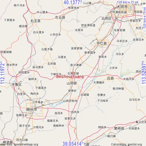
Beizhouzhuang GPS coordinates[2]
39° 35' 52.944" North, 112° 49' 22.224" East
| Map corner | latitude | longitude |
|---|---|---|
| Upper-left | 40.1377°, | 112.11972° |
| Center: | 39.59804°, | 112.82284° |
| Lower-right: | 39.05414°, | 113.52597° |
| Map W x H: | 120.5×120.5 km | = 74.9×74.9mi |
| max Lat: | 53.31946° ⇑15.1% North |
| Beizhouzhuang: | 39.59804° |
| min Lat: | ⇓84.9% South 18.22056° |
| min Long | Beizhouzhuang | max Long |
| 75.07348° | 112.82284° | 134.28917° |
| W 41.4%⇐ | ⇒58.6% E |
Elevation
Elevation of Beizhouzhuang is 1050 m = 3445 ft, and this is 565.2 m = 1854 ft above average elevation for this country.
| Max E: |
5622 m = 18445 ft | 13.9% |
| Beizhouzhuang | 1050 m 3445 ft | |
| Avg. | 484.8 m = 1591 ft | |
Min E: |
-3 m = -10 ft | 86.1% |
See also: China elevation on elevation.city.
Geographical zone
Beizhouzhuang is located in North temperate zone (between Tropic of Cancer and the Arctic Circle). Distance of this Northern Tropic circle is 1797 km =1116.6 mi to South.| Distance of | km | miles | from Beizhouzhuang |
|---|---|---|---|
| North Pole | 5604.2 | 3482.3 | to North |
| Arctic Circle | 2998.3 | 1863.1 | to North |
| Tropic Cancer | 1797 | 1116.6 | to South |
| Equator | 4402.9 | 2735.8 | to South |


Nearby cities:
15 places around Beizhouzhuang: (largest is in red/bold)
• Anrong
14.3 km =8.9 mi,  182°
182°
• Dahuangwei
22.6 km =14 mi,  109°
109°
• Daiyue
8.7 km =5.4 mi, 183°
• Gucheng
20 km =12.4 mi,  151°
151°
• Heshengbao
7.5 km =4.7 mi, 109°
• Maying
16.3 km =10.1 mi,  326°
326°
• Mayingzhuang
29 km =18 mi, 151°
• Qingshuihe
28 km =17.4 mi,  60°
60°
• Wujiayao
20.9 km =13 mi,  7°
7°
• Xialaba
14.2 km =8.8 mi,  267°
267°
• Xiamiangao
28.9 km =18 mi,  247°
247°
• Xinjiayuan
22.2 km =13.8 mi,  38°
38°
• Xuekulue
21.3 km =13.2 mi,  186°
186°
• Yujing
20.7 km =12.9 mi,  294°
294°
• Zangzhai
25.2 km =15.7 mi,  81°
81°
Sources, notices
• [Note1] Compared only with cities in China existing in our database
• [Src1] Map data: © OpenStreetMap contributors (CC-BY-SA)
• [Src2] Other city data from geonames.org with taken over terms of usage.
• [Src3] Geographical zone / Annual Mean Temperature by Robert A. Rohde @ Wikipedia
