Banqiao geodata
Banqiao (Henan) is a seat of a fourth-order administrative division; located in China in Asia/Shanghai (GMT+8) time zone. In our database, there are 1268 cities with bigger population. Compared to other cities in China, 66% of cities are located further ↓South; 53.5% of cities are located further →East and 57.2% of cities have higher elevation than Banqiao. Note1


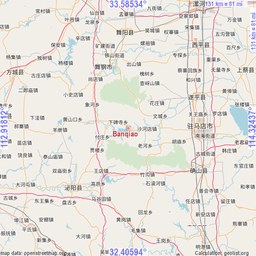
Banqiao GPS coordinates[2]
32° 59' 51.396" North, 113° 37' 16.464" East
| Map corner | latitude | longitude |
|---|---|---|
| Upper-left | 33.58534°, | 112.91812° |
| Center: | 32.99761°, | 113.62124° |
| Lower-right: | 32.40594°, | 114.32437° |
| Map W x H: | 131.1×131.1 km | = 81.5×81.5mi |
| max Lat: | 53.31946° ⇑34% North |
| Banqiao: | 32.99761° |
| min Lat: | ⇓66% South 18.22056° |
| min Long | Banqiao | max Long |
| 75.07348° | 113.62124° | 134.28917° |
| W 46.5%⇐ | ⇒53.5% E |
Elevation
Elevation of Banqiao is 116 m = 381 ft, and this is 368.8 m = 1210 ft below average elevation for this country.
| Max E: |
5622 m = 18445 ft | 57.2% |
| Avg. | 484.8 m = 1591 ft | |
| Banqiao | 116 m = 381 ft | |
Min E: |
-3 m = -10 ft | 42.8% |
See also: China elevation on elevation.city.
Geographical zone
Banqiao is located in North temperate zone (between Tropic of Cancer and the Arctic Circle). Distance of this Northern Tropic circle is 1063.1 km =660.6 mi to South.| Distance of | km | miles | from Banqiao |
|---|---|---|---|
| North Pole | 6338.1 | 3938.3 | to North |
| Arctic Circle | 3732.2 | 2319.1 | to North |
| Tropic Cancer | 1063.1 | 660.6 | to South |
| Equator | 3669 | 2279.8 | to South |


Nearby cities:
15 places around Banqiao: (largest is in red/bold)
• Chunshui
15.7 km =9.8 mi,  284°
284°
• Fuzhuang
14 km =8.7 mi,  251°
251°
• Huangshankou
28.8 km =17.9 mi, 279°
• Jialou
19.6 km =12.2 mi,  234°
234°
• Laohe
12.3 km =7.6 mi,  134°
134°
• Shahedian
9.7 km =6 mi,  90°
90°
• Tongshan
25.7 km =16 mi,  193°
193°
• Wangdian
25.6 km =15.9 mi,  212°
212°
• Wencheng
17.7 km =11 mi,  68°
68°
• Xiabeisi
6.1 km =3.8 mi,  303°
303°
• Xianghe
22.1 km =13.7 mi, 304°
• Yangfeng
26.4 km =16.4 mi,  54°
54°
• Yinji
28.5 km =17.7 mi,  351°
351°
• Yushan
28.8 km =17.9 mi,  38°
38°
• Zhushi
25.9 km =16.1 mi, 74°
Sources, notices
• [Note1] Compared only with cities in China existing in our database
• [Src1] Map data: © OpenStreetMap contributors (CC-BY-SA)
• [Src2] Other city data from geonames.org with taken over terms of usage.
• [Src3] Geographical zone / Annual Mean Temperature by Robert A. Rohde @ Wikipedia
