Baiyu geodata
Baiyu (Qinghai) is a seat of a fourth-order administrative division; located in China in Asia/Shanghai (GMT+8) time zone. In our database, there are 1268 cities with bigger population. Compared to other cities in China, 67.3% of cities are located further ↓South; 94.1% of cities are located further →East and 98.4% of cities have lower elevation than Baiyu. Note1


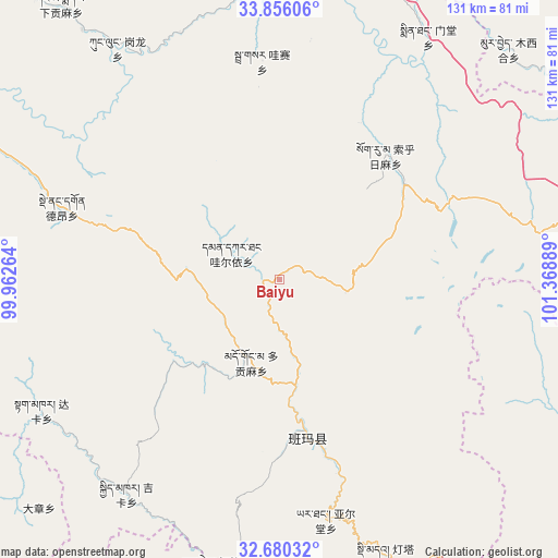
Baiyu GPS coordinates[2]
33° 16' 12.612" North, 100° 39' 56.736" East
| Map corner | latitude | longitude |
|---|---|---|
| Upper-left | 33.85606°, | 99.96264° |
| Center: | 33.27017°, | 100.66576° |
| Lower-right: | 32.68032°, | 101.36889° |
| Map W x H: | 130.7×130.7 km | = 81.2×81.2mi |
| max Lat: | 53.31946° ⇑32.7% North |
| Baiyu: | 33.27017° |
| min Lat: | ⇓67.3% South 18.22056° |
| min Long | Baiyu | max Long |
| 75.07348° | 100.66576° | 134.28917° |
| W 5.9%⇐ | ⇒94.1% E |
Elevation
Elevation of Baiyu is 3894 m = 12776 ft, and this is 3409.2 m = 11185 ft above average elevation for this country.
| Max E: |
5622 m = 18445 ft | 1.6% |
| Baiyu | 3894 m 12776 ft | |
| Avg. | 484.8 m = 1591 ft | |
Min E: |
-3 m = -10 ft | 98.4% |
See also: China elevation on elevation.city.
Geographical zone
Baiyu is located in North temperate zone (between Tropic of Cancer and the Arctic Circle). Distance of this Northern Tropic circle is 1093.4 km =679.4 mi to South.| Distance of | km | miles | from Baiyu |
|---|---|---|---|
| North Pole | 6307.8 | 3919.5 | to North |
| Arctic Circle | 3701.9 | 2300.3 | to North |
| Tropic Cancer | 1093.4 | 679.4 | to South |
| Equator | 3699.3 | 2298.6 | to South |


Nearby cities:
15 places around Baiyu: (largest is in red/bold)
• Basar
51.9 km =32.2 mi,  353°
353°
• Dagkar
63.6 km =39.5 mi,  241°
241°
• Dimda
69.4 km =43.1 mi,  158°
158°
• Duogongma
20.5 km =12.7 mi,  198°
198°
• Dêrnang
49.8 km =30.9 mi,  291°
291°
• Ganglong
66.6 km =41.4 mi,  325°
325°
• Gyimkar
61.8 km =38.4 mi,  215°
215°
• Jiangritang
40.3 km =25 mi,  165°
165°
• Markog
27.1 km =16.8 mi, 220°
• Marzhing
24.9 km =15.5 mi,  277°
277°
• Mintang
68.1 km =42.3 mi,  30°
30°
• Sailaitang
37.8 km =23.5 mi, 169°
• Suohurima
37.9 km =23.5 mi,  40°
40°
• Wa’eryi
12.9 km =8 mi,  297°
297°
• Yartang
57.5 km =35.7 mi, 168°
Sources, notices
• [Note1] Compared only with cities in China existing in our database
• [Src1] Map data: © OpenStreetMap contributors (CC-BY-SA)
• [Src2] Other city data from geonames.org with taken over terms of usage.
• [Src3] Geographical zone / Annual Mean Temperature by Robert A. Rohde @ Wikipedia
