Sailaitang geodata
Sailaitang (Qinghai) is a seat of a third-order administrative division; located in China in Asia/Shanghai (GMT+8) time zone. In our database, there are 1268 cities with bigger population. Compared to other cities in China, 65.7% of cities are located further ↓South; 94% of cities are located further →East and 97.8% of cities have lower elevation than Sailaitang. Note1


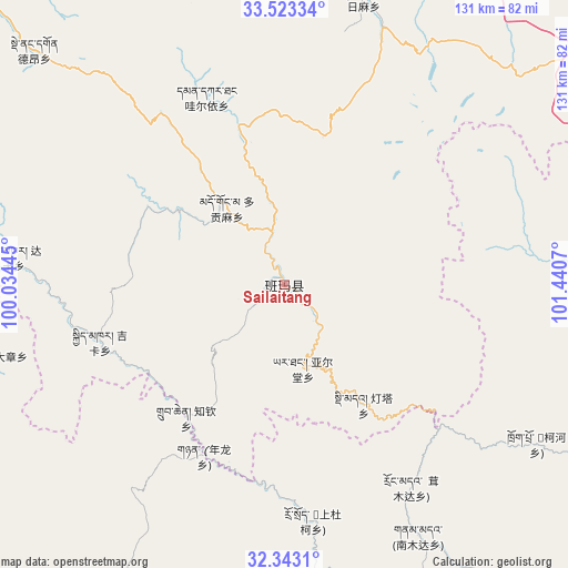
Sailaitang GPS coordinates[2]
32° 56' 6.684" North, 100° 44' 15.252" East
| Map corner | latitude | longitude |
|---|---|---|
| Upper-left | 33.52334°, | 100.03445° |
| Center: | 32.93519°, | 100.73757° |
| Lower-right: | 32.3431°, | 101.4407° |
| Map W x H: | 131.2×131.2 km | = 81.5×81.5mi |
| max Lat: | 53.31946° ⇑34.3% North |
| Sailaitang: | 32.93519° |
| min Lat: | ⇓65.7% South 18.22056° |
| min Long | Sailaitang | max Long |
| 75.07348° | 100.73757° | 134.28917° |
| W 6%⇐ | ⇒94% E |
Elevation
Elevation of Sailaitang is 3522 m = 11555 ft, and this is 3037.2 m = 9965 ft above average elevation for this country.
| Max E: |
5622 m = 18445 ft | 2.2% |
| Sailaitang | 3522 m 11555 ft | |
| Avg. | 484.8 m = 1591 ft | |
Min E: |
-3 m = -10 ft | 97.8% |
See also: China elevation on elevation.city.
Geographical zone
Sailaitang is located in North temperate zone (between Tropic of Cancer and the Arctic Circle). Distance of this Northern Tropic circle is 1056.1 km =656.2 mi to South.| Distance of | km | miles | from Sailaitang |
|---|---|---|---|
| North Pole | 6345 | 3942.6 | to North |
| Arctic Circle | 3739.1 | 2323.4 | to North |
| Tropic Cancer | 1056.1 | 656.2 | to South |
| Equator | 3662 | 2275.5 | to South |


Nearby cities:
15 places around Sailaitang: (largest is in red/bold)
• Andou
75.9 km =47.2 mi,  84°
84°
• Baiyu
37.8 km =23.5 mi,  349°
349°
• Dagkar
62.9 km =39.1 mi,  276°
276°
• Dimda
33.1 km =20.6 mi,  146°
146°
• Duogongma
22.3 km =13.9 mi,  323°
323°
• Dêrnang
76.7 km =47.7 mi, 316°
• Gyimkar
44.6 km =27.7 mi,  253°
253°
• Jiangritang
3.7 km =2.3 mi,  119°
119°
• Kehe
71.8 km =44.6 mi, 122°
• Markog
29.3 km =18.2 mi,  304°
304°
• Marzhing
51.3 km =31.9 mi, 322°
• Suohurima
68.4 km =42.5 mi,  15°
15°
• Wa’eryi
46.9 km =29.1 mi,  337°
337°
• Yartang
19.6 km =12.2 mi,  167°
167°
• Zhiqin
38 km =23.6 mi,  216°
216°
Sources, notices
• [Note1] Compared only with cities in China existing in our database
• [Src1] Map data: © OpenStreetMap contributors (CC-BY-SA)
• [Src2] Other city data from geonames.org with taken over terms of usage.
• [Src3] Geographical zone / Annual Mean Temperature by Robert A. Rohde @ Wikipedia
