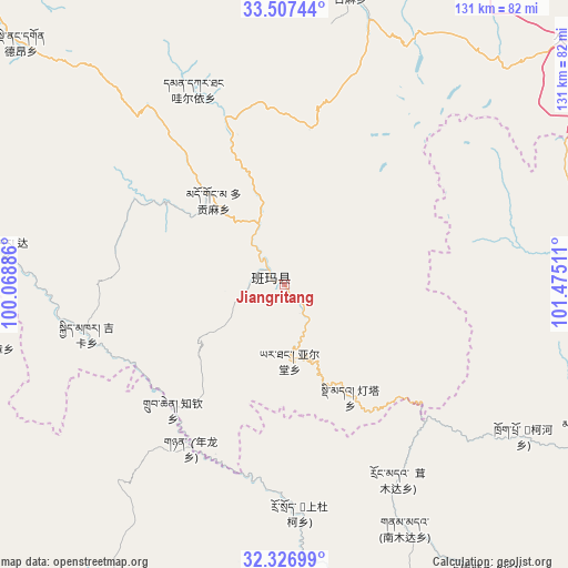
Jiangritang geodata
Jiangritang (Qinghai) is a seat of a fourth-order administrative division; located in China in Asia/Shanghai (GMT+8) time zone. In our database, there are 1268 cities with bigger population. Compared to other cities in China, 65.6% of cities are located further ↓South; 94% of cities are located further →East and 97.8% of cities have lower elevation than Jiangritang. Note1


Jiangritang GPS coordinates[2]
32° 55' 9.048" North, 100° 46' 19.128" East
| Map corner | latitude | longitude |
|---|---|---|
| Upper-left | 33.50744°, | 100.06886° |
| Center: | 32.91918°, | 100.77198° |
| Lower-right: | 32.32699°, | 101.47511° |
| Map W x H: | 131.3×131.3 km | = 81.6×81.6mi |
| max Lat: | 53.31946° ⇑34.4% North |
| Jiangritang: | 32.91918° |
| min Lat: | ⇓65.6% South 18.22056° |
| min Long | Jiangritang | max Long |
| 75.07348° | 100.77198° | 134.28917° |
| W 6%⇐ | ⇒94% E |
Elevation
Elevation of Jiangritang is 3507 m = 11506 ft, and this is 3022.2 m = 9915 ft above average elevation for this country.
| Max E: |
5622 m = 18445 ft | 2.2% |
| Jiangritang | 3507 m 11506 ft | |
| Avg. | 484.8 m = 1591 ft | |
Min E: |
-3 m = -10 ft | 97.8% |
See also: China elevation on elevation.city.
Geographical zone
Jiangritang is located in North temperate zone (between Tropic of Cancer and the Arctic Circle). Distance of this Northern Tropic circle is 1054.4 km =655.2 mi to South.| Distance of | km | miles | from Jiangritang |
|---|---|---|---|
| North Pole | 6346.8 | 3943.7 | to North |
| Arctic Circle | 3740.9 | 2324.5 | to North |
| Tropic Cancer | 1054.4 | 655.2 | to South |
| Equator | 3660.3 | 2274.4 | to South |


Nearby cities:
15 places around Jiangritang: (largest is in red/bold)
• Andou
72.9 km =45.3 mi,  82°
82°
• Baiyu
40.3 km =25 mi,  345°
345°
• Dagkar
66.3 km =41.2 mi,  277°
277°
• Dimda
29.9 km =18.6 mi,  149°
149°
• Duogongma
25.6 km =15.9 mi,  320°
320°
• Gyimkar
47.3 km =29.4 mi,  256°
256°
• Jia’erduo
75.7 km =47 mi, 82°
• Kehe
68.1 km =42.3 mi,  122°
122°
• Markog
33 km =20.5 mi,  303°
303°
• Marzhing
54.7 km =34 mi, 320°
• Sailaitang
3.7 km =2.3 mi, 299°
• Suohurima
69.4 km =43.1 mi,  12°
12°
• Wa’eryi
49.8 km =30.9 mi,  334°
334°
• Yartang
17.4 km =10.8 mi,  176°
176°
• Zhiqin
38.7 km =24 mi,  222°
222°
Sources, notices
• [Note1] Compared only with cities in China existing in our database
• [Src1] Map data: © OpenStreetMap contributors (CC-BY-SA)
• [Src2] Other city data from geonames.org with taken over terms of usage.
• [Src3] Geographical zone / Annual Mean Temperature by Robert A. Rohde @ Wikipedia
