Mintang geodata
Mintang (Qinghai) is a seat of a fourth-order administrative division; located in China in Asia/Shanghai (GMT+8) time zone. In our database, there are 1268 cities with bigger population. Compared to other cities in China, 69.3% of cities are located further ↓South; 93.8% of cities are located further →East and 98% of cities have lower elevation than Mintang. Note1


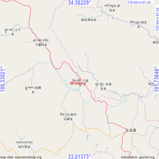
Mintang GPS coordinates[2]
33° 48' 0" North, 101° 1' 59.988" East
| Map corner | latitude | longitude |
|---|---|---|
| Upper-left | 34.38229°, | 100.33021° |
| Center: | 33.8°, | 101.03333° |
| Lower-right: | 33.21373°, | 101.73646° |
| Map W x H: | 129.9×129.9 km | = 80.7×80.7mi |
| max Lat: | 53.31946° ⇑30.7% North |
| Mintang: | 33.8° |
| min Lat: | ⇓69.3% South 18.22056° |
| min Long | Mintang | max Long |
| 75.07348° | 101.03333° | 134.28917° |
| W 6.2%⇐ | ⇒93.8% E |
Elevation
Elevation of Mintang is 3631 m = 11913 ft, and this is 3146.2 m = 10322 ft above average elevation for this country.
| Max E: |
5622 m = 18445 ft | 2% |
| Mintang | 3631 m 11913 ft | |
| Avg. | 484.8 m = 1591 ft | |
Min E: |
-3 m = -10 ft | 98% |
See also: China elevation on elevation.city.
Geographical zone
Mintang is located in North temperate zone (between Tropic of Cancer and the Arctic Circle). Distance of this Northern Tropic circle is 1152.3 km =716 mi to South.| Distance of | km | miles | from Mintang |
|---|---|---|---|
| North Pole | 6248.9 | 3882.9 | to North |
| Arctic Circle | 3643 | 2263.7 | to North |
| Tropic Cancer | 1152.3 | 716 | to South |
| Equator | 3758.2 | 2335.2 | to South |


Nearby cities:
15 places around Mintang: (largest is in red/bold)
• Awancang
61.4 km =38.2 mi,  93°
93°
• Baiyu
68.1 km =42.3 mi,  210°
210°
• Basar
40.7 km =25.3 mi,  259°
259°
• Duosong
64.6 km =40.1 mi,  24°
24°
• Ganglong
71.9 km =44.7 mi,  266°
266°
• Gyangqai
71.2 km =44.2 mi,  304°
304°
• Kesheng
66 km =41 mi,  46°
46°
• Muxihe
20.2 km =12.6 mi,  103°
103°
• Oula
70.6 km =43.9 mi,  64°
64°
• Oula Xiuma
49.8 km =30.9 mi,  9°
9°
• Qiujima
66.8 km =41.5 mi,  124°
124°
• Suohurima
31.6 km =19.6 mi,  197°
197°
• Wa’eryi
69.8 km =43.4 mi,  220°
220°
• Xia Zanggor
42.9 km =26.7 mi,  313°
313°
• Zhiqing Songduo
55.1 km =34.2 mi,  137°
137°
Sources, notices
• [Note1] Compared only with cities in China existing in our database
• [Src1] Map data: © OpenStreetMap contributors (CC-BY-SA)
• [Src2] Other city data from geonames.org with taken over terms of usage.
• [Src3] Geographical zone / Annual Mean Temperature by Robert A. Rohde @ Wikipedia
