Baisha geodata
Baisha (Jiangxi) is a seat of a fourth-order administrative division; located in China in Asia/Shanghai (GMT+8) time zone. In our database, there are 1268 cities with bigger population. Compared to other cities in China, 78.8% of cities are located further ↑North; 56.6% of cities are located further ←West and 60.4% of cities have higher elevation than Baisha. Note1


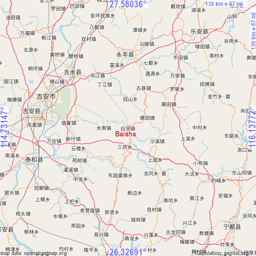
Baisha GPS coordinates[2]
26° 57' 19.368" North, 115° 26' 4.524" East
| Map corner | latitude | longitude |
|---|---|---|
| Upper-left | 27.58036°, | 114.73147° |
| Center: | 26.95538°, | 115.43459° |
| Lower-right: | 26.32691°, | 116.13772° |
| Map W x H: | 139.4×139.4 km | = 86.6×86.6mi |
| max Lat: | 53.31946° ⇑78.8% North |
| Baisha: | 26.95538° |
| min Lat: | ⇓21.2% South 18.22056° |
| min Long | Baisha | max Long |
| 75.07348° | 115.43459° | 134.28917° |
| W 56.6%⇐ | ⇒43.4% E |
Elevation
Elevation of Baisha is 96 m = 315 ft, and this is 388.8 m = 1276 ft below average elevation for this country.
| Max E: |
5622 m = 18445 ft | 60.4% |
| Avg. | 484.8 m = 1591 ft | |
| Baisha | 96 m = 315 ft | |
Min E: |
-3 m = -10 ft | 39.6% |
See also: China elevation on elevation.city.
Geographical zone
Baisha is located in North temperate zone (between Tropic of Cancer and the Arctic Circle). Distance of this Northern Tropic circle is 391.2 km =243.1 mi to South.| Distance of | km | miles | from Baisha |
|---|---|---|---|
| North Pole | 7009.9 | 4355.7 | to North |
| Arctic Circle | 4404 | 2736.5 | to North |
| Tropic Cancer | 391.2 | 243.1 | to South |
| Equator | 2997.2 | 1862.4 | to South |


Nearby cities:
15 places around Baisha: (largest is in red/bold)
• Baishui
15.3 km =9.5 mi,  333°
333°
• Dingjiang
27.2 km =16.9 mi, 331°
• Donggu
26 km =16.2 mi,  189°
189°
• Futian
23.6 km =14.7 mi,  231°
231°
• Guanshan
16.1 km =10 mi,  4°
4°
• Guxian
23.4 km =14.5 mi,  19°
19°
• Longgang Shezu
28.3 km =17.6 mi,  148°
148°
• Luotian
12.2 km =7.6 mi,  58°
58°
• Sanfang
9.8 km =6.1 mi, 191°
• Shanggu
22.5 km =14 mi,  139°
139°
• Shaxi
17.2 km =10.7 mi,  113°
113°
• Shuinan
13.3 km =8.3 mi,  271°
271°
• Tantou
14.2 km =8.8 mi,  157°
157°
• Tengtian
26.1 km =16.2 mi, 58°
• Yaotian
26.7 km =16.6 mi,  43°
43°
Sources, notices
• [Note1] Compared only with cities in China existing in our database
• [Src1] Map data: © OpenStreetMap contributors (CC-BY-SA)
• [Src2] Other city data from geonames.org with taken over terms of usage.
• [Src3] Geographical zone / Annual Mean Temperature by Robert A. Rohde @ Wikipedia
