Baicha geodata
Baicha (Jiangxi) is a seat of a fourth-order administrative division; located in China in Asia/Shanghai (GMT+8) time zone. In our database, there are 1268 cities with bigger population. Compared to other cities in China, 63.4% of cities are located further ↑North; 57.5% of cities are located further ←West and 78.8% of cities have higher elevation than Baicha. Note1


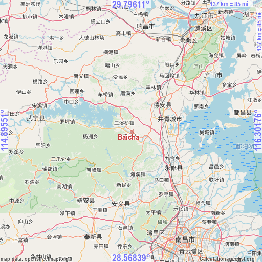
Baicha GPS coordinates[2]
29° 11' 2.724" North, 115° 35' 55.068" East
| Map corner | latitude | longitude |
|---|---|---|
| Upper-left | 29.79611°, | 114.89551° |
| Center: | 29.18409°, | 115.59863° |
| Lower-right: | 28.56839°, | 116.30176° |
| Map W x H: | 136.5×136.5 km | = 84.8×84.8mi |
| max Lat: | 53.31946° ⇑63.4% North |
| Baicha: | 29.18409° |
| min Lat: | ⇓36.6% South 18.22056° |
| min Long | Baicha | max Long |
| 75.07348° | 115.59863° | 134.28917° |
| W 57.5%⇐ | ⇒42.5% E |
Elevation
Elevation of Baicha is 29 m = 95 ft, and this is 455.8 m = 1495 ft below average elevation for this country.
| Max E: |
5622 m = 18445 ft | 78.8% |
| Avg. | 484.8 m = 1591 ft | |
| Baicha | 29 m = 95 ft | |
Min E: |
-3 m = -10 ft | 21.2% |
See also: China elevation on elevation.city.
Geographical zone
Baicha is located in North temperate zone (between Tropic of Cancer and the Arctic Circle). Distance of this Northern Tropic circle is 639 km =397.1 mi to South.| Distance of | km | miles | from Baicha |
|---|---|---|---|
| North Pole | 6762.1 | 4201.8 | to North |
| Arctic Circle | 4156.2 | 2582.5 | to North |
| Tropic Cancer | 639 | 397.1 | to South |
| Equator | 3245 | 2016.3 | to South |


Nearby cities:
15 places around Baicha: (largest is in red/bold)
• Aicheng
19.1 km =11.9 mi,  123°
123°
• Baota
21.6 km =13.4 mi,  43°
43°
• Ganlu
17.8 km =11.1 mi,  64°
64°
• Jiangshang
2.2 km =1.4 mi,  189°
189°
• Jiangyi
17.2 km =10.7 mi,  79°
79°
• Lixin
22.7 km =14.1 mi,  142°
142°
• Meitang
7.3 km =4.5 mi,  23°
23°
• Moxi
20.3 km =12.6 mi,  354°
354°
• Puting
22.5 km =14 mi, 43°
• Qiujin
8 km =5 mi,  101°
101°
• Tanxi
22.5 km =14 mi,  171°
171°
• Yanfang
10.8 km =6.7 mi,  66°
66°
• Yangzhou
21.3 km =13.2 mi,  263°
263°
• Zhelin
9.4 km =5.8 mi,  287°
287°
• Zhelin
13.9 km =8.6 mi, 293°
Sources, notices
• [Note1] Compared only with cities in China existing in our database
• [Src1] Map data: © OpenStreetMap contributors (CC-BY-SA)
• [Src2] Other city data from geonames.org with taken over terms of usage.
• [Src3] Geographical zone / Annual Mean Temperature by Robert A. Rohde @ Wikipedia
