Badu geodata
Badu (Jiangxi) is a seat of a fourth-order administrative division; located in China in Asia/Shanghai (GMT+8) time zone. In our database, there are 1268 cities with bigger population. Compared to other cities in China, 76.8% of cities are located further ↑North; 55.7% of cities are located further ←West and 65.8% of cities have higher elevation than Badu. Note1


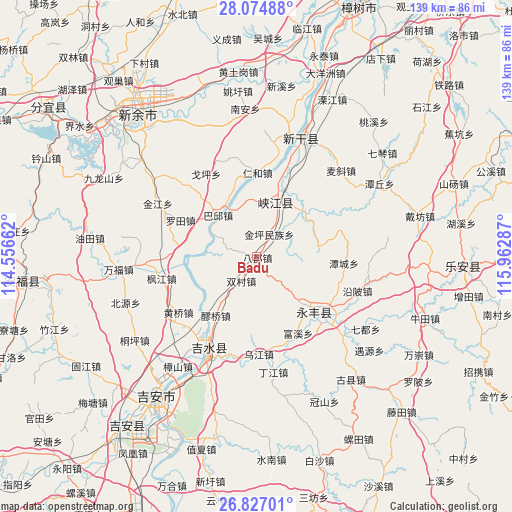
Badu GPS coordinates[2]
27° 27' 9.756" North, 115° 15' 35.064" East
| Map corner | latitude | longitude |
|---|---|---|
| Upper-left | 28.07488°, | 114.55662° |
| Center: | 27.45271°, | 115.25974° |
| Lower-right: | 26.82701°, | 115.96287° |
| Map W x H: | 138.8×138.8 km | = 86.2×86.2mi |
| max Lat: | 53.31946° ⇑76.8% North |
| Badu: | 27.45271° |
| min Lat: | ⇓23.2% South 18.22056° |
| min Long | Badu | max Long |
| 75.07348° | 115.25974° | 134.28917° |
| W 55.7%⇐ | ⇒44.3% E |
Elevation
Elevation of Badu is 69 m = 226 ft, and this is 415.8 m = 1364 ft below average elevation for this country.
| Max E: |
5622 m = 18445 ft | 65.8% |
| Avg. | 484.8 m = 1591 ft | |
| Badu | 69 m = 226 ft | |
Min E: |
-3 m = -10 ft | 34.2% |
See also: China elevation on elevation.city.
Geographical zone
Badu is located in North temperate zone (between Tropic of Cancer and the Arctic Circle). Distance of this Northern Tropic circle is 446.5 km =277.4 mi to South.| Distance of | km | miles | from Badu |
|---|---|---|---|
| North Pole | 6954.6 | 4321.4 | to North |
| Arctic Circle | 4348.7 | 2702.2 | to North |
| Tropic Cancer | 446.5 | 277.4 | to South |
| Equator | 3052.5 | 1896.7 | to South |


Nearby cities:
15 places around Badu: (largest is in red/bold)
• Baqiu
15.4 km =9.6 mi,  316°
316°
• Enjiang
22.2 km =13.8 mi,  131°
131°
• Fumin
14.2 km =8.8 mi,  340°
340°
• Jintan
24.5 km =15.2 mi,  214°
214°
• Kengtian
16.8 km =10.4 mi,  135°
135°
• Laoqiao
20.4 km =12.7 mi, 214°
• Luotian
22.9 km =14.2 mi,  295°
295°
• Mabu
17.7 km =11 mi,  47°
47°
• Renhe
22.7 km =14.1 mi,  0°
0°
• Shuangcun
7.7 km =4.8 mi, 212°
• Shuibian
18.5 km =11.5 mi,  20°
20°
• Shuitian
11.6 km =7.2 mi,  252°
252°
• Tancheng
23.5 km =14.6 mi,  94°
94°
• Tonglin
17 km =10.6 mi,  67°
67°
• Zuolong
21.3 km =13.2 mi, 136°
Sources, notices
• [Note1] Compared only with cities in China existing in our database
• [Src1] Map data: © OpenStreetMap contributors (CC-BY-SA)
• [Src2] Other city data from geonames.org with taken over terms of usage.
• [Src3] Geographical zone / Annual Mean Temperature by Robert A. Rohde @ Wikipedia
