Shuangcun geodata
Shuangcun (Jiangxi) is a seat of a fourth-order administrative division; located in China in Asia/Shanghai (GMT+8) time zone. In our database, there are 1268 cities with bigger population. Compared to other cities in China, 77% of cities are located further ↑North; 55.4% of cities are located further ←West and 64.3% of cities have higher elevation than Shuangcun. Note1


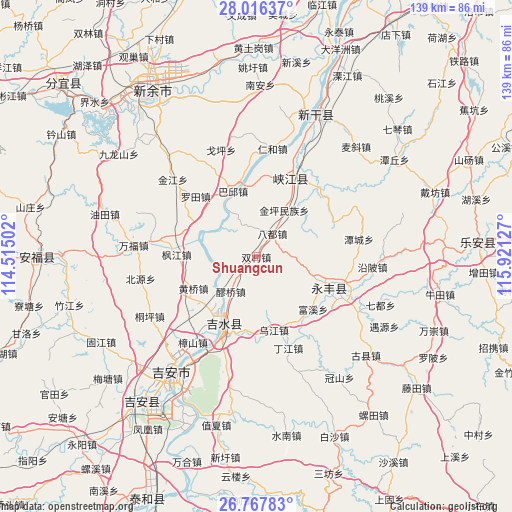
Shuangcun GPS coordinates[2]
27° 23' 37.896" North, 115° 13' 5.304" East
| Map corner | latitude | longitude |
|---|---|---|
| Upper-left | 28.01637°, | 114.51502° |
| Center: | 27.39386°, | 115.21814° |
| Lower-right: | 26.76783°, | 115.92127° |
| Map W x H: | 138.8×138.8 km | = 86.2×86.2mi |
| max Lat: | 53.31946° ⇑77% North |
| Shuangcun: | 27.39386° |
| min Lat: | ⇓23% South 18.22056° |
| min Long | Shuangcun | max Long |
| 75.07348° | 115.21814° | 134.28917° |
| W 55.4%⇐ | ⇒44.6% E |
Elevation
Elevation of Shuangcun is 76 m = 249 ft, and this is 408.8 m = 1341 ft below average elevation for this country.
| Max E: |
5622 m = 18445 ft | 64.3% |
| Avg. | 484.8 m = 1591 ft | |
| Shuangcun | 76 m = 249 ft | |
Min E: |
-3 m = -10 ft | 35.7% |
See also: China elevation on elevation.city.
Geographical zone
Shuangcun is located in North temperate zone (between Tropic of Cancer and the Arctic Circle). Distance of this Northern Tropic circle is 440 km =273.4 mi to South.| Distance of | km | miles | from Shuangcun |
|---|---|---|---|
| North Pole | 6961.2 | 4325.5 | to North |
| Arctic Circle | 4355.3 | 2706.3 | to North |
| Tropic Cancer | 440 | 273.4 | to South |
| Equator | 3045.9 | 1892.6 | to South |


Nearby cities:
15 places around Shuangcun: (largest is in red/bold)
• Badu
7.7 km =4.8 mi,  32°
32°
• Baqiu
18.8 km =11.7 mi,  339°
339°
• Enjiang
22.3 km =13.9 mi,  111°
111°
• Fengjiang
21.4 km =13.3 mi,  271°
271°
• Fumin
19.9 km =12.4 mi,  358°
358°
• Huangqiao
19.3 km =12 mi,  243°
243°
• Jintan
16.8 km =10.4 mi,  215°
215°
• Kengtian
16.8 km =10.4 mi, 108°
• Laoqiao
12.7 km =7.9 mi, 216°
• Luotian
23.3 km =14.5 mi,  314°
314°
• Pangu
21.3 km =13.2 mi,  281°
281°
• Shuitian
7.6 km =4.7 mi,  294°
294°
• Tonglin
23.8 km =14.8 mi,  56°
56°
• Wujiang
20.5 km =12.7 mi,  167°
167°
• Zuolong
20.8 km =12.9 mi,  115°
115°
Sources, notices
• [Note1] Compared only with cities in China existing in our database
• [Src1] Map data: © OpenStreetMap contributors (CC-BY-SA)
• [Src2] Other city data from geonames.org with taken over terms of usage.
• [Src3] Geographical zone / Annual Mean Temperature by Robert A. Rohde @ Wikipedia
