Lengshui geodata
Lengshui (Zhejiang) is a seat of a fourth-order administrative division; located in China in Asia/Shanghai (GMT+8) time zone. In our database, there are 1268 cities with bigger population. Compared to other cities in China, 66.3% of cities are located further ↑North; 84.2% of cities are located further ←West and 60.6% of cities have lower elevation than Lengshui. Note1


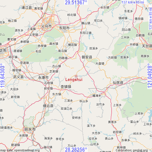
Lengshui GPS coordinates[2]
28° 53' 59.784" North, 120° 20' 46.14" East
| Map corner | latitude | longitude |
|---|---|---|
| Upper-left | 29.51367°, | 119.64303° |
| Center: | 28.89994°, | 120.34615° |
| Lower-right: | 28.28256°, | 121.04928° |
| Map W x H: | 136.9×136.9 km | = 85.1×85.1mi |
| max Lat: | 53.31946° ⇑66.3% North |
| Lengshui: | 28.89994° |
| min Lat: | ⇓33.7% South 18.22056° |
| min Long | Lengshui | max Long |
| 75.07348° | 120.34615° | 134.28917° |
| W 84.2%⇐ | ⇒15.8% E |
Elevation
Elevation of Lengshui is 267 m = 876 ft, and this is 217.8 m = 715 ft below average elevation for this country.
| Max E: |
5622 m = 18445 ft | 39.4% |
| Avg. | 484.8 m = 1591 ft | |
| Lengshui | 267 m = 876 ft | |
Min E: |
-3 m = -10 ft | 60.6% |
See also: China elevation on elevation.city.
Geographical zone
Lengshui is located in North temperate zone (between Tropic of Cancer and the Arctic Circle). Distance of this Northern Tropic circle is 607.5 km =377.5 mi to South.| Distance of | km | miles | from Lengshui |
|---|---|---|---|
| North Pole | 6793.7 | 4221.4 | to North |
| Arctic Circle | 4187.8 | 2602.2 | to North |
| Tropic Cancer | 607.5 | 377.5 | to South |
| Equator | 3213.4 | 1996.7 | to South |


Nearby cities:
15 places around Lengshui: (largest is in red/bold)
• Anwen
19.9 km =12.4 mi,  26°
26°
• Baizhu
6.1 km =3.8 mi,  280°
280°
• Fangyan
15.9 km =9.9 mi,  285°
285°
• Gushan
20 km =12.4 mi,  297°
297°
• Huzhen
13.7 km =8.5 mi,  221°
221°
• Longshan
21 km =13 mi,  310°
310°
• Panfeng
19.4 km =12.1 mi,  77°
77°
• Pan’an
19.3 km =12 mi, 27°
• Qianlu
16.9 km =10.5 mi,  209°
209°
• Qianxiang
16.2 km =10.1 mi,  348°
348°
• Sanlian
15.8 km =9.8 mi,  359°
359°
• Shuangfeng
11.2 km =7 mi, 75°
• Xinwo
6 km =3.7 mi, 26°
• Yanling
9.3 km =5.8 mi, 217°
• Zhoushan
19.9 km =12.4 mi,  237°
237°
Sources, notices
• [Note1] Compared only with cities in China existing in our database
• [Src1] Map data: © OpenStreetMap contributors (CC-BY-SA)
• [Src2] Other city data from geonames.org with taken over terms of usage.
• [Src3] Geographical zone / Annual Mean Temperature by Robert A. Rohde @ Wikipedia
