Guyi geodata
Guyi (Hubei) is a seat of a fourth-order administrative division; located in China in Asia/Shanghai (GMT+8) time zone. In our database, there are 1268 cities with bigger population. Compared to other cities in China, 62.8% of cities are located further ↓South; 61.5% of cities are located further →East and 60.3% of cities have higher elevation than Guyi. Note1


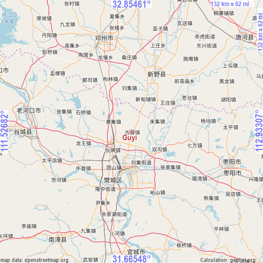
Guyi GPS coordinates[2]
32° 15' 43.164" North, 112° 13' 47.784" East
| Map corner | latitude | longitude |
|---|---|---|
| Upper-left | 32.85461°, | 111.52682° |
| Center: | 32.26199°, | 112.22994° |
| Lower-right: | 31.66548°, | 112.93307° |
| Map W x H: | 132.2×132.2 km | = 82.1×82.1mi |
| max Lat: | 53.31946° ⇑37.2% North |
| Guyi: | 32.26199° |
| min Lat: | ⇓62.8% South 18.22056° |
| min Long | Guyi | max Long |
| 75.07348° | 112.22994° | 134.28917° |
| W 38.5%⇐ | ⇒61.5% E |
Elevation
Elevation of Guyi is 97 m = 318 ft, and this is 387.8 m = 1272 ft below average elevation for this country.
| Max E: |
5622 m = 18445 ft | 60.3% |
| Avg. | 484.8 m = 1591 ft | |
| Guyi | 97 m = 318 ft | |
Min E: |
-3 m = -10 ft | 39.7% |
See also: China elevation on elevation.city.
Geographical zone
Guyi is located in North temperate zone (between Tropic of Cancer and the Arctic Circle). Distance of this Northern Tropic circle is 981.3 km =609.8 mi to South.| Distance of | km | miles | from Guyi |
|---|---|---|---|
| North Pole | 6419.9 | 3989.1 | to North |
| Arctic Circle | 3814 | 2369.9 | to North |
| Tropic Cancer | 981.3 | 609.8 | to South |
| Equator | 3587.2 | 2229 | to South |


Nearby cities:
15 places around Guyi: (largest is in red/bold)
• Chenghe
19.3 km =12 mi,  79°
79°
• Dongjin
26.3 km =16.3 mi,  181°
181°
• Dongxiang
28.5 km =17.7 mi,  123°
123°
• Huangji
10.7 km =6.6 mi,  300°
300°
• Huopai
14.7 km =9.1 mi,  221°
221°
• Longwang
24.8 km =15.4 mi,  257°
257°
• Mizhuang
15.7 km =9.8 mi,  206°
206°
• Shipu
27.7 km =17.2 mi, 211°
• Shiqiao
26 km =16.2 mi,  292°
292°
• Shuanggou
16.3 km =10.1 mi, 119°
• Tuanshan
19.8 km =12.3 mi, 206°
• Wangzha
25.3 km =15.7 mi,  204°
204°
• Xiangyang
25.7 km =16 mi, 198°
• Zhangjiaji
26.2 km =16.3 mi,  132°
132°
• Zhangwan
20.7 km =12.9 mi, 196°
Sources, notices
• [Note1] Compared only with cities in China existing in our database
• [Src1] Map data: © OpenStreetMap contributors (CC-BY-SA)
• [Src2] Other city data from geonames.org with taken over terms of usage.
• [Src3] Geographical zone / Annual Mean Temperature by Robert A. Rohde @ Wikipedia
