Songling geodata
Songling (Jiangsu) is a seat of a third-order administrative division; located in China in Asia/Shanghai (GMT+8) time zone. With population of 77,566 people, there are 551 cities with bigger population in this country. Compared to other cities in China, 56.2% of cities are located further ↓South; 86.4% of cities are located further ←West and 97.2% of cities have higher elevation than Songling. Note1


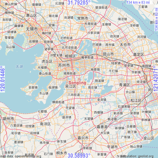
Songling GPS coordinates[2]
31° 11' 35.88" North, 120° 43' 3.288" East
| Map corner | latitude | longitude |
|---|---|---|
| Upper-left | 31.79285°, | 120.01446° |
| Center: | 31.1933°, | 120.71758° |
| Lower-right: | 30.58993°, | 121.42071° |
| Map W x H: | 133.8×133.8 km | = 83.1×83.1mi |
| max Lat: | 53.31946° ⇑43.8% North |
| Songling: | 31.1933° |
| min Lat: | ⇓56.2% South 18.22056° |
| min Long | Songling | max Long |
| 75.07348° | 120.71758° | 134.28917° |
| W 86.4%⇐ | ⇒13.6% E |
Elevation
Elevation of Songling is 5 m = 16 ft, and this is 479.8 m = 1574 ft below average elevation for this country.
| Max E: |
5622 m = 18445 ft | 97.2% |
| Avg. | 484.8 m = 1591 ft | |
| Songling | 5 m = 16 ft | |
Min E: |
-3 m = -10 ft | 2.8% |
See also: Songling elevation on elevation.city.
Geographical zone
Songling is located in North temperate zone (between Tropic of Cancer and the Arctic Circle). Distance of this Northern Tropic circle is 862.5 km =535.9 mi to South.| Distance of | km | miles | from Songling |
|---|---|---|---|
| North Pole | 6538.7 | 4063 | to North |
| Arctic Circle | 3932.8 | 2443.7 | to North |
| Tropic Cancer | 862.5 | 535.9 | to South |
| Equator | 3468.4 | 2155.2 | to South |


Nearby cities:
15 places around Songling: (largest is in red/bold)
• Guoxiang
8.1 km =5 mi,  327°
327°
• Hengjing
17.9 km =11.1 mi,  262°
262°
• Jinxi
16.8 km =10.4 mi,  95°
95°
• Loufeng
12.2 km =7.6 mi, 332°
• Luzhi
17 km =10.6 mi,  57°
57°
• Pingjianglu
15.9 km =9.9 mi, 328°
• Shengpu
15.6 km =9.7 mi,  37°
37°
• Shilu
17.6 km =10.9 mi,  318°
318°
• Shuangta
14.9 km =9.3 mi, 325°
• Songlong
8.3 km =5.2 mi,  245°
245°
• Suzhou
16.9 km =10.5 mi, 316°
• Tongli
3.6 km =2.2 mi,  188°
188°
• Weiting
17.2 km =10.7 mi,  352°
352°
• Yuexi
12.9 km =8 mi,  281°
281°
• Zhouzhuang
14.7 km =9.1 mi,  124°
124°
Sources, notices
• [Note1] Compared only with cities in China existing in our database
• [Src1] Map data: © OpenStreetMap contributors (CC-BY-SA)
• [Src2] Other city data from geonames.org with taken over terms of usage.
• [Src3] Geographical zone / Annual Mean Temperature by Robert A. Rohde @ Wikipedia
