Qingjiangyi geodata
Qingjiangyi (Gansu) is a seat of a fourth-order administrative division; located in China in Asia/Shanghai (GMT+8) time zone. In our database, there are 1268 cities with bigger population. Compared to other cities in China, 76.5% of cities are located further ↓South; 88.4% of cities are located further →East and 93.9% of cities have lower elevation than Qingjiangyi. Note1


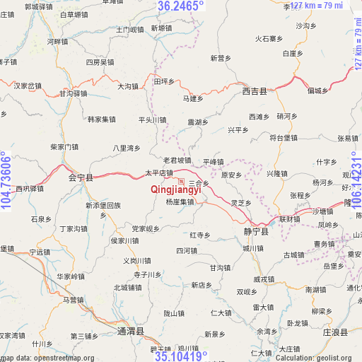
Qingjiangyi GPS coordinates[2]
35° 40' 38.604" North, 105° 26' 21.048" East
| Map corner | latitude | longitude |
|---|---|---|
| Upper-left | 36.2465°, | 104.73606° |
| Center: | 35.67739°, | 105.43918° |
| Lower-right: | 35.10419°, | 106.14231° |
| Map W x H: | 127×127 km | = 78.9×78.9mi |
| max Lat: | 53.31946° ⇑23.5% North |
| Qingjiangyi: | 35.67739° |
| min Lat: | ⇓76.5% South 18.22056° |
| min Long | Qingjiangyi | max Long |
| 75.07348° | 105.43918° | 134.28917° |
| W 11.6%⇐ | ⇒88.4% E |
Elevation
Elevation of Qingjiangyi is 1862 m = 6109 ft, and this is 1377.2 m = 4518 ft above average elevation for this country.
| Max E: |
5622 m = 18445 ft | 6.1% |
| Qingjiangyi | 1862 m 6109 ft | |
| Avg. | 484.8 m = 1591 ft | |
Min E: |
-3 m = -10 ft | 93.9% |
See also: China elevation on elevation.city.
Geographical zone
Qingjiangyi is located in North temperate zone (between Tropic of Cancer and the Arctic Circle). Distance of this Northern Tropic circle is 1361 km =845.7 mi to South.| Distance of | km | miles | from Qingjiangyi |
|---|---|---|---|
| North Pole | 6040.1 | 3753.1 | to North |
| Arctic Circle | 3434.2 | 2133.9 | to North |
| Tropic Cancer | 1361 | 845.7 | to South |
| Equator | 3967 | 2465 | to South |


Nearby cities:
15 places around Qingjiangyi: (largest is in red/bold)
• Dangjiaxian
20.6 km =12.8 mi,  217°
217°
• Gongyi
25.6 km =15.9 mi,  86°
86°
• Hanjiaji
35.7 km =22.2 mi,  308°
308°
• Houjiachuan
28.5 km =17.7 mi, 223°
• Huishi
35.3 km =21.9 mi,  272°
272°
• Jieshipu
11.6 km =7.2 mi,  129°
129°
• Jingning Chengguanzhen
31 km =19.3 mi,  124°
124°
• Laojunpo
7.9 km =4.9 mi,  348°
348°
• Pingfeng
13.2 km =8.2 mi,  57°
57°
• Wangmin
30.1 km =18.7 mi, 62°
• Xindian
36.9 km =22.9 mi,  168°
168°
• Xinglong
33.6 km =20.9 mi,  84°
84°
• Xingping
27 km =16.8 mi,  47°
47°
• Xitan
35.6 km =22.1 mi, 49°
• Yuan’an
17.8 km =11.1 mi, 81°
Sources, notices
• [Note1] Compared only with cities in China existing in our database
• [Src1] Map data: © OpenStreetMap contributors (CC-BY-SA)
• [Src2] Other city data from geonames.org with taken over terms of usage.
• [Src3] Geographical zone / Annual Mean Temperature by Robert A. Rohde @ Wikipedia
