Tieshan geodata
Tieshan (Chongqing) is a seat of a fourth-order administrative division; located in China in Asia/Shanghai (GMT+8) time zone. In our database, there are 1268 cities with bigger population. Compared to other cities in China, 57.6% of cities are located further ↑North; 88.2% of cities are located further →East and 69.3% of cities have lower elevation than Tieshan. Note1


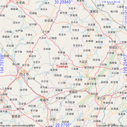
Tieshan GPS coordinates[2]
29° 41' 22.092" North, 105° 30' 3.6" East
| Map corner | latitude | longitude |
|---|---|---|
| Upper-left | 30.29843°, | 104.79788° |
| Center: | 29.68947°, | 105.501° |
| Lower-right: | 29.0768°, | 106.20413° |
| Map W x H: | 135.8×135.8 km | = 84.4×84.4mi |
| max Lat: | 53.31946° ⇑57.6% North |
| Tieshan: | 29.68947° |
| min Lat: | ⇓42.4% South 18.22056° |
| min Long | Tieshan | max Long |
| 75.07348° | 105.501° | 134.28917° |
| W 11.8%⇐ | ⇒88.2% E |
Elevation
Elevation of Tieshan is 397 m = 1302 ft, and this is 87.8 m = 288 ft below average elevation for this country.
| Max E: |
5622 m = 18445 ft | 30.7% |
| Avg. | 484.8 m = 1591 ft | |
| Tieshan | 397 m = 1302 ft | |
Min E: |
-3 m = -10 ft | 69.3% |
See also: China elevation on elevation.city.
Geographical zone
Tieshan is located in North temperate zone (between Tropic of Cancer and the Arctic Circle). Distance of this Northern Tropic circle is 695.2 km =432 mi to South.| Distance of | km | miles | from Tieshan |
|---|---|---|---|
| North Pole | 6705.9 | 4166.9 | to North |
| Arctic Circle | 4100 | 2547.6 | to North |
| Tropic Cancer | 695.2 | 432 | to South |
| Equator | 3301.2 | 2051.3 | to South |


Nearby cities:
15 places around Tieshan: (largest is in red/bold)
• Baoxing
20 km =12.4 mi,  112°
112°
• Gaosheng
8.1 km =5 mi,  67°
67°
• Guansheng
13.8 km =8.6 mi,  206°
206°
• Hebao
14.3 km =8.9 mi,  163°
163°
• Lijia
7.2 km =4.5 mi,  152°
152°
• Longgang
20.6 km =12.8 mi,  87°
87°
• Longshi
18.3 km =11.4 mi,  142°
142°
• Qingliu
20 km =12.4 mi,  236°
236°
• Renyi
20.4 km =12.7 mi,  186°
186°
• Sanqu
12.8 km =8 mi, 114°
• Tangxiang
21.6 km =13.4 mi, 86°
• Tonggu
9.8 km =6.1 mi,  199°
199°
• Wujia
12.2 km =7.6 mi, 240°
• Yuanjue
23 km =14.3 mi,  230°
230°
• Zhong’ao
18 km =11.2 mi,  62°
62°
Sources, notices
• [Note1] Compared only with cities in China existing in our database
• [Src1] Map data: © OpenStreetMap contributors (CC-BY-SA)
• [Src2] Other city data from geonames.org with taken over terms of usage.
• [Src3] Geographical zone / Annual Mean Temperature by Robert A. Rohde @ Wikipedia
