Wulong geodata
Wulong (Gansu) is a seat of a fourth-order administrative division; located in China in Asia/Shanghai (GMT+8) time zone. In our database, there are 1268 cities with bigger population. Compared to other cities in China, 74.1% of cities are located further ↓South; 88.2% of cities are located further →East and 93.2% of cities have lower elevation than Wulong. Note1


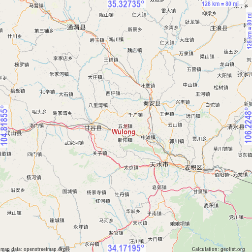
Wulong GPS coordinates[2]
34° 45' 6.012" North, 105° 31' 18.012" East
| Map corner | latitude | longitude |
|---|---|---|
| Upper-left | 35.32735°, | 104.81855° |
| Center: | 34.75167°, | 105.52167° |
| Lower-right: | 34.17195°, | 106.2248° |
| Map W x H: | 128.5×128.5 km | = 79.8×79.8mi |
| max Lat: | 53.31946° ⇑25.9% North |
| Wulong: | 34.75167° |
| min Lat: | ⇓74.1% South 18.22056° |
| min Long | Wulong | max Long |
| 75.07348° | 105.52167° | 134.28917° |
| W 11.8%⇐ | ⇒88.2% E |
Elevation
Elevation of Wulong is 1736 m = 5696 ft, and this is 1251.2 m = 4105 ft above average elevation for this country.
| Max E: |
5622 m = 18445 ft | 6.8% |
| Wulong | 1736 m 5696 ft | |
| Avg. | 484.8 m = 1591 ft | |
Min E: |
-3 m = -10 ft | 93.2% |
See also: China elevation on elevation.city.
Geographical zone
Wulong is located in North temperate zone (between Tropic of Cancer and the Arctic Circle). Distance of this Northern Tropic circle is 1258.1 km =781.7 mi to South.| Distance of | km | miles | from Wulong |
|---|---|---|---|
| North Pole | 6143 | 3817.1 | to North |
| Arctic Circle | 3537.2 | 2197.9 | to North |
| Tropic Cancer | 1258.1 | 781.7 | to South |
| Equator | 3864 | 2401 | to South |


Nearby cities:
15 places around Wulong: (largest is in red/bold)
• Beidao
39.6 km =24.6 mi,  120°
120°
• Gangu Chengguanzhen
17.9 km =11.1 mi,  264°
264°
• Haodi
35.2 km =21.9 mi,  37°
37°
• Jichuan
44.7 km =27.8 mi,  353°
353°
• Liangshan
54.6 km =33.9 mi,  49°
49°
• Lianhua
42.3 km =26.3 mi, 35°
• Lidian
55 km =34.2 mi,  15°
15°
• Liuping
23.8 km =14.8 mi, 49°
• Longcheng
49.7 km =30.9 mi,  56°
56°
• Qincheng
26.8 km =16.7 mi,  135°
135°
• Taijing
21.1 km =13.1 mi,  173°
173°
• Tianshui
27.8 km =17.3 mi,  133°
133°
• Wangpu
34.9 km =21.7 mi, 347°
• Wangyin
23.7 km =14.7 mi,  67°
67°
• Xingguo
17.9 km =11.1 mi, 48°
Sources, notices
• [Note1] Compared only with cities in China existing in our database
• [Src1] Map data: © OpenStreetMap contributors (CC-BY-SA)
• [Src2] Other city data from geonames.org with taken over terms of usage.
• [Src3] Geographical zone / Annual Mean Temperature by Robert A. Rohde @ Wikipedia
