Majia geodata
Majia (Shaanxi) is a seat of a fourth-order administrative division; located in China in Asia/Shanghai (GMT+8) time zone. In our database, there are 1268 cities with bigger population. Compared to other cities in China, 71.6% of cities are located further ↓South; 81.5% of cities are located further →East and 73.9% of cities have lower elevation than Majia. Note1


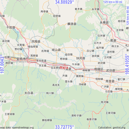
Majia GPS coordinates[2]
34° 18' 37.908" North, 107° 42' 26.712" East
| Map corner | latitude | longitude |
|---|---|---|
| Upper-left | 34.88929°, | 107.0043° |
| Center: | 34.31053°, | 107.70742° |
| Lower-right: | 33.72775°, | 108.41055° |
| Map W x H: | 129.2×129.2 km | = 80.3×80.3mi |
| max Lat: | 53.31946° ⇑28.4% North |
| Majia: | 34.31053° |
| min Lat: | ⇓71.6% South 18.22056° |
| min Long | Majia | max Long |
| 75.07348° | 107.70742° | 134.28917° |
| W 18.5%⇐ | ⇒81.5% E |
Elevation
Elevation of Majia is 499 m = 1637 ft, and this is 14.2 m = 47 ft above average elevation for this country.
| Max E: |
5622 m = 18445 ft | 26.1% |
| Majia | 499 m 1637 ft | |
| Avg. | 484.8 m = 1591 ft | |
Min E: |
-3 m = -10 ft | 73.9% |
See also: China elevation on elevation.city.
Geographical zone
Majia is located in North temperate zone (between Tropic of Cancer and the Arctic Circle). Distance of this Northern Tropic circle is 1209.1 km =751.3 mi to South.| Distance of | km | miles | from Majia |
|---|---|---|---|
| North Pole | 6192.1 | 3847.6 | to North |
| Arctic Circle | 3586.2 | 2228.4 | to North |
| Tropic Cancer | 1209.1 | 751.3 | to South |
| Equator | 3815 | 2370.5 | to South |


Nearby cities:
15 places around Majia: (largest is in red/bold)
• Anle
10.8 km =6.7 mi,  203°
203°
• Caijiapo
10.4 km =6.5 mi,  280°
280°
• Caojia
11.8 km =7.3 mi,  231°
231°
• Changxing
12.6 km =7.8 mi,  110°
110°
• Daying
11.5 km =7.1 mi,  341°
341°
• Fufeng
16.2 km =10.1 mi,  69°
69°
• Gujun
14.4 km =8.9 mi,  353°
353°
• Jinqu
12.8 km =8 mi,  149°
149°
• Qizhen
11.1 km =6.9 mi,  177°
177°
• Shoushan
5.1 km =3.2 mi,  135°
135°
• Wujing
10.9 km =6.8 mi,  86°
86°
• Wuzhangyuan
9.2 km =5.7 mi,  251°
251°
• Yidian
11.2 km =7 mi,  22°
22°
• Yongchuan
8.9 km =5.5 mi,  313°
313°
• Zaolin
6 km =3.7 mi, 350°
Sources, notices
• [Note1] Compared only with cities in China existing in our database
• [Src1] Map data: © OpenStreetMap contributors (CC-BY-SA)
• [Src2] Other city data from geonames.org with taken over terms of usage.
• [Src3] Geographical zone / Annual Mean Temperature by Robert A. Rohde @ Wikipedia
