Zaolin geodata
Zaolin (Shaanxi) is a seat of a fourth-order administrative division; located in China in Asia/Shanghai (GMT+8) time zone. In our database, there are 1268 cities with bigger population. Compared to other cities in China, 71.9% of cities are located further ↓South; 81.6% of cities are located further →East and 79.2% of cities have lower elevation than Zaolin. Note1


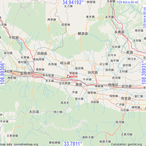
Zaolin GPS coordinates[2]
34° 21' 48.672" North, 107° 41' 46.248" East
| Map corner | latitude | longitude |
|---|---|---|
| Upper-left | 34.94192°, | 106.99306° |
| Center: | 34.36352°, | 107.69618° |
| Lower-right: | 33.7811°, | 108.39931° |
| Map W x H: | 129.1×129.1 km | = 80.2×80.2mi |
| max Lat: | 53.31946° ⇑28.1% North |
| Zaolin: | 34.36352° |
| min Lat: | ⇓71.9% South 18.22056° |
| min Long | Zaolin | max Long |
| 75.07348° | 107.69618° | 134.28917° |
| W 18.4%⇐ | ⇒81.6% E |
Elevation
Elevation of Zaolin is 659 m = 2162 ft, and this is 174.2 m = 572 ft above average elevation for this country.
| Max E: |
5622 m = 18445 ft | 20.8% |
| Zaolin | 659 m 2162 ft | |
| Avg. | 484.8 m = 1591 ft | |
Min E: |
-3 m = -10 ft | 79.2% |
See also: China elevation on elevation.city.
Geographical zone
Zaolin is located in North temperate zone (between Tropic of Cancer and the Arctic Circle). Distance of this Northern Tropic circle is 1214.9 km =754.9 mi to South.| Distance of | km | miles | from Zaolin |
|---|---|---|---|
| North Pole | 6186.2 | 3843.9 | to North |
| Arctic Circle | 3580.3 | 2224.7 | to North |
| Tropic Cancer | 1214.9 | 754.9 | to South |
| Equator | 3820.9 | 2374.2 | to South |


Nearby cities:
15 places around Zaolin: (largest is in red/bold)
• Caijiapo
10 km =6.2 mi,  246°
246°
• Caojia
15.6 km =9.7 mi,  211°
211°
• Daying
5.7 km =3.5 mi,  332°
332°
• Fengming
11.3 km =7 mi,  320°
320°
• Gujun
8.5 km =5.3 mi,  355°
355°
• Guowang
15.8 km =9.8 mi,  278°
278°
• Majia
6 km =3.7 mi,  170°
170°
• Pucun
13.2 km =8.2 mi,  22°
22°
• Qinghua
14.6 km =9.1 mi,  61°
61°
• Shoushan
10.6 km =6.6 mi,  154°
154°
• Wujing
13 km =8.1 mi,  114°
114°
• Wuzhangyuan
11.7 km =7.3 mi,  220°
220°
• Yidian
6.9 km =4.3 mi,  49°
49°
• Yongchuan
5.4 km =3.4 mi,  272°
272°
• Zhujiazhuang
14.4 km =8.9 mi,  32°
32°
Sources, notices
• [Note1] Compared only with cities in China existing in our database
• [Src1] Map data: © OpenStreetMap contributors (CC-BY-SA)
• [Src2] Other city data from geonames.org with taken over terms of usage.
• [Src3] Geographical zone / Annual Mean Temperature by Robert A. Rohde @ Wikipedia
