Gunziying geodata
Gunziying (Henan) is a seat of a fourth-order administrative division; located in China in Asia/Shanghai (GMT+8) time zone. In our database, there are 1268 cities with bigger population. Compared to other cities in China, 68.6% of cities are located further ↓South; 56.9% of cities are located further →East and 57.5% of cities have higher elevation than Gunziying. Note1


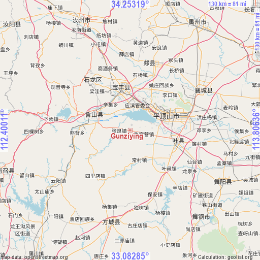
Gunziying GPS coordinates[2]
33° 40' 12.036" North, 113° 6' 11.628" East
| Map corner | latitude | longitude |
|---|---|---|
| Upper-left | 34.25319°, | 112.40011° |
| Center: | 33.67001°, | 113.10323° |
| Lower-right: | 33.08285°, | 113.80636° |
| Map W x H: | 130.1×130.1 km | = 80.8×80.8mi |
| max Lat: | 53.31946° ⇑31.4% North |
| Gunziying: | 33.67001° |
| min Lat: | ⇓68.6% South 18.22056° |
| min Long | Gunziying | max Long |
| 75.07348° | 113.10323° | 134.28917° |
| W 43.1%⇐ | ⇒56.9% E |
Elevation
Elevation of Gunziying is 114 m = 374 ft, and this is 370.8 m = 1217 ft below average elevation for this country.
| Max E: |
5622 m = 18445 ft | 57.5% |
| Avg. | 484.8 m = 1591 ft | |
| Gunziying | 114 m = 374 ft | |
Min E: |
-3 m = -10 ft | 42.5% |
See also: China elevation on elevation.city.
Geographical zone
Gunziying is located in North temperate zone (between Tropic of Cancer and the Arctic Circle). Distance of this Northern Tropic circle is 1137.8 km =707 mi to South.| Distance of | km | miles | from Gunziying |
|---|---|---|---|
| North Pole | 6263.3 | 3891.8 | to North |
| Arctic Circle | 3657.4 | 2272.6 | to North |
| Tropic Cancer | 1137.8 | 707 | to South |
| Equator | 3743.8 | 2326.3 | to South |


Nearby cities:
15 places around Gunziying: (largest is in red/bold)
• Beidu
17.5 km =10.9 mi,  76°
76°
• Caozhen
10.9 km =6.8 mi,  69°
69°
• Changcun
15.3 km =9.5 mi,  173°
173°
• Jiaodian
15.5 km =9.6 mi,  45°
45°
• Luyang
19.7 km =12.2 mi,  291°
291°
• Malou
10.9 km =6.8 mi,  275°
275°
• Pingdingshan
19.8 km =12.3 mi, 67°
• Rendian
12.4 km =7.7 mi,  112°
112°
• Xiali
18.5 km =11.5 mi,  146°
146°
• Xinji
16.3 km =10.1 mi,  324°
324°
• Yangzhuang
19.5 km =12.1 mi,  341°
341°
• Zhangguanying
6.8 km =4.2 mi, 105°
• Zhangliang
5.8 km =3.6 mi,  269°
269°
• Zhiyang
13.3 km =8.3 mi,  12°
12°
• Zhouzhuang
21.2 km =13.2 mi,  3°
3°
Sources, notices
• [Note1] Compared only with cities in China existing in our database
• [Src1] Map data: © OpenStreetMap contributors (CC-BY-SA)
• [Src2] Other city data from geonames.org with taken over terms of usage.
• [Src3] Geographical zone / Annual Mean Temperature by Robert A. Rohde @ Wikipedia
