Rendian geodata
Rendian (Henan) is a seat of a fourth-order administrative division; located in China in Asia/Shanghai (GMT+8) time zone. In our database, there are 1268 cities with bigger population. Compared to other cities in China, 68.4% of cities are located further ↓South; 56.1% of cities are located further →East and 59.4% of cities have higher elevation than Rendian. Note1


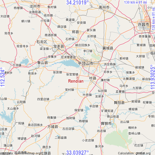
Rendian GPS coordinates[2]
33° 37' 36.192" North, 113° 13' 37.632" East
| Map corner | latitude | longitude |
|---|---|---|
| Upper-left | 34.21019°, | 112.524° |
| Center: | 33.62672°, | 113.22712° |
| Lower-right: | 33.03927°, | 113.93025° |
| Map W x H: | 130.2×130.2 km | = 80.9×80.9mi |
| max Lat: | 53.31946° ⇑31.6% North |
| Rendian: | 33.62672° |
| min Lat: | ⇓68.4% South 18.22056° |
| min Long | Rendian | max Long |
| 75.07348° | 113.22712° | 134.28917° |
| W 43.9%⇐ | ⇒56.1% E |
Elevation
Elevation of Rendian is 102 m = 335 ft, and this is 382.8 m = 1256 ft below average elevation for this country.
| Max E: |
5622 m = 18445 ft | 59.4% |
| Avg. | 484.8 m = 1591 ft | |
| Rendian | 102 m = 335 ft | |
Min E: |
-3 m = -10 ft | 40.6% |
See also: China elevation on elevation.city.
Geographical zone
Rendian is located in North temperate zone (between Tropic of Cancer and the Arctic Circle). Distance of this Northern Tropic circle is 1133 km =704 mi to South.| Distance of | km | miles | from Rendian |
|---|---|---|---|
| North Pole | 6268.1 | 3894.8 | to North |
| Arctic Circle | 3662.2 | 2275.6 | to North |
| Tropic Cancer | 1133 | 704 | to South |
| Equator | 3738.9 | 2323.2 | to South |


Nearby cities:
15 places around Rendian: (largest is in red/bold)
• Beidu
10.5 km =6.5 mi,  31°
31°
• Caozhen
8.7 km =5.4 mi,  352°
352°
• Changcun
14.3 km =8.9 mi,  223°
223°
• Donggaohuang
19.3 km =12 mi,  40°
40°
• Gunziying
12.4 km =7.7 mi,  292°
292°
• Jiaodian
15.6 km =9.7 mi,  358°
358°
• Jiuxian
16.1 km =10 mi,  155°
155°
• Kunyang
10.9 km =6.8 mi,  93°
93°
• Mazhuang
11.5 km =7.1 mi,  110°
110°
• Pingdingshan
14.2 km =8.8 mi, 28°
• Tianzhuang
13.4 km =8.3 mi,  119°
119°
• Xiali
10.7 km =6.6 mi,  187°
187°
• Zhangguanying
5.7 km =3.5 mi,  302°
302°
• Zhangliang
17.9 km =11.1 mi, 285°
• Zunhuadian
18.3 km =11.4 mi,  61°
61°
Sources, notices
• [Note1] Compared only with cities in China existing in our database
• [Src1] Map data: © OpenStreetMap contributors (CC-BY-SA)
• [Src2] Other city data from geonames.org with taken over terms of usage.
• [Src3] Geographical zone / Annual Mean Temperature by Robert A. Rohde @ Wikipedia
