Mucun geodata
Mucun (Hebei) is a seat of a fourth-order administrative division; located in China in Asia/Shanghai (GMT+8) time zone. In our database, there are 1268 cities with bigger population. Compared to other cities in China, 81.7% of cities are located further ↓South; 52.5% of cities are located further ←West and 63.3% of cities have higher elevation than Mucun. Note1


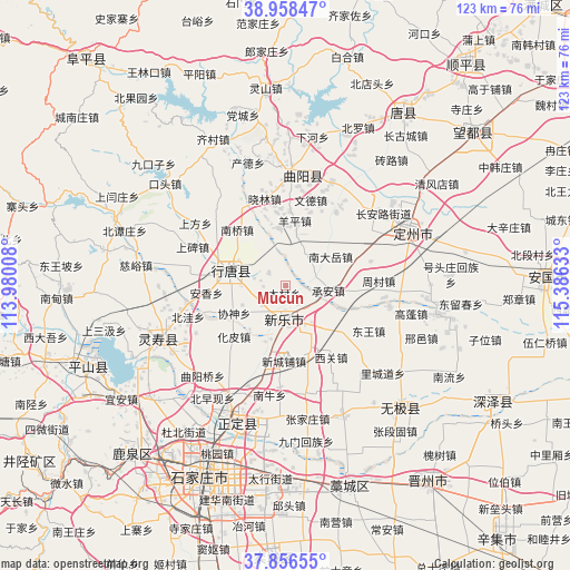
Mucun GPS coordinates[2]
38° 24' 34.596" North, 114° 40' 59.52" East
| Map corner | latitude | longitude |
|---|---|---|
| Upper-left | 38.95847°, | 113.98008° |
| Center: | 38.40961°, | 114.6832° |
| Lower-right: | 37.85655°, | 115.38633° |
| Map W x H: | 122.5×122.5 km | = 76.1×76.1mi |
| max Lat: | 53.31946° ⇑18.3% North |
| Mucun: | 38.40961° |
| min Lat: | ⇓81.7% South 18.22056° |
| min Long | Mucun | max Long |
| 75.07348° | 114.6832° | 134.28917° |
| W 52.5%⇐ | ⇒47.5% E |
Elevation
Elevation of Mucun is 81 m = 266 ft, and this is 403.8 m = 1325 ft below average elevation for this country.
| Max E: |
5622 m = 18445 ft | 63.3% |
| Avg. | 484.8 m = 1591 ft | |
| Mucun | 81 m = 266 ft | |
Min E: |
-3 m = -10 ft | 36.7% |
See also: China elevation on elevation.city.
Geographical zone
Mucun is located in North temperate zone (between Tropic of Cancer and the Arctic Circle). Distance of this Northern Tropic circle is 1664.8 km =1034.5 mi to South.| Distance of | km | miles | from Mucun |
|---|---|---|---|
| North Pole | 5736.3 | 3564.4 | to North |
| Arctic Circle | 3130.4 | 1945.1 | to North |
| Tropic Cancer | 1664.8 | 1034.5 | to South |
| Equator | 4270.7 | 2653.7 | to South |


Nearby cities:
15 places around Mucun: (largest is in red/bold)
• Anxiang
12.8 km =8 mi,  256°
256°
• Cheng’an
9.2 km =5.7 mi,  97°
97°
• Dicun
12.6 km =7.8 mi,  28°
28°
• Dugu
15.8 km =9.8 mi, 95°
• Duyanggang
9.6 km =6 mi,  299°
299°
• Huapi
15.5 km =9.6 mi,  225°
225°
• Nandayue
11.9 km =7.4 mi,  52°
52°
• Nanqiao
15.8 km =9.8 mi,  318°
318°
• Pengjiazhuang
7.3 km =4.5 mi,  124°
124°
• Xieshen
12.8 km =8 mi,  241°
241°
• Xinchengpu
15.8 km =9.8 mi,  180°
180°
• Xipingle
15.7 km =9.8 mi,  193°
193°
• Yangping
13.4 km =8.3 mi,  9°
9°
• Zhengmo
7.7 km =4.8 mi, 33°
• Zhili
9.2 km =5.7 mi, 263°
Sources, notices
• [Note1] Compared only with cities in China existing in our database
• [Src1] Map data: © OpenStreetMap contributors (CC-BY-SA)
• [Src2] Other city data from geonames.org with taken over terms of usage.
• [Src3] Geographical zone / Annual Mean Temperature by Robert A. Rohde @ Wikipedia
