Duyanggang geodata
Duyanggang (Henan) is a seat of a fourth-order administrative division; located in China in Asia/Shanghai (GMT+8) time zone. In our database, there are 1268 cities with bigger population. Compared to other cities in China, 81.7% of cities are located further ↓South; 52% of cities are located further ←West and 60.1% of cities have higher elevation than Duyanggang. Note1


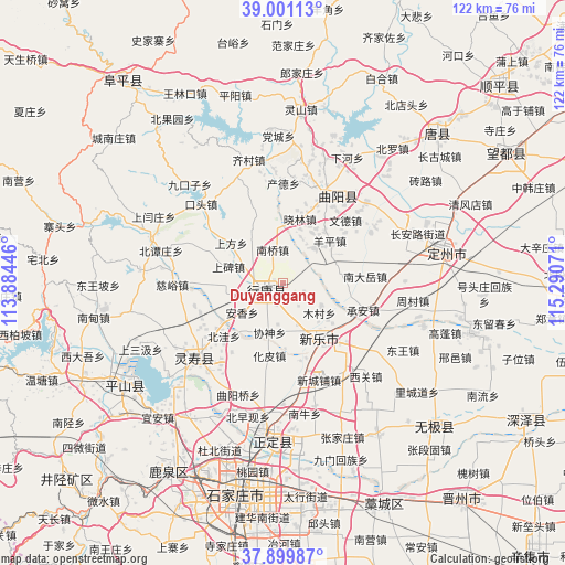
Duyanggang GPS coordinates[2]
38° 27' 9.36" North, 114° 35' 15.288" East
| Map corner | latitude | longitude |
|---|---|---|
| Upper-left | 39.00113°, | 113.88446° |
| Center: | 38.4526°, | 114.58758° |
| Lower-right: | 37.89987°, | 115.29071° |
| Map W x H: | 122.4×122.4 km | = 76.1×76.1mi |
| max Lat: | 53.31946° ⇑18.3% North |
| Duyanggang: | 38.4526° |
| min Lat: | ⇓81.7% South 18.22056° |
| min Long | Duyanggang | max Long |
| 75.07348° | 114.58758° | 134.28917° |
| W 52%⇐ | ⇒48% E |
Elevation
Elevation of Duyanggang is 98 m = 322 ft, and this is 386.8 m = 1269 ft below average elevation for this country.
| Max E: |
5622 m = 18445 ft | 60.1% |
| Avg. | 484.8 m = 1591 ft | |
| Duyanggang | 98 m = 322 ft | |
Min E: |
-3 m = -10 ft | 39.9% |
See also: China elevation on elevation.city.
Geographical zone
Duyanggang is located in North temperate zone (between Tropic of Cancer and the Arctic Circle). Distance of this Northern Tropic circle is 1669.6 km =1037.4 mi to South.| Distance of | km | miles | from Duyanggang |
|---|---|---|---|
| North Pole | 5731.5 | 3561.4 | to North |
| Arctic Circle | 3125.6 | 1942.2 | to North |
| Tropic Cancer | 1669.6 | 1037.4 | to South |
| Equator | 4275.5 | 2656.7 | to South |


Nearby cities:
15 places around Duyanggang: (largest is in red/bold)
• Anxiang
8.7 km =5.4 mi,  208°
208°
• Dicun
15.7 km =9.8 mi,  66°
66°
• Diying
13 km =8.1 mi,  261°
261°
• Huapi
15.9 km =9.9 mi,  189°
189°
• Mucun
9.6 km =6 mi,  119°
119°
• Nanqiao
7.3 km =4.5 mi,  342°
342°
• Shangbei
11.9 km =7.4 mi,  287°
287°
• Shangfang
14 km =8.7 mi,  306°
306°
• Shitong
7.9 km =4.9 mi,  250°
250°
• Xiaolin
13.9 km =8.6 mi,  16°
16°
• Xieshen
11.3 km =7 mi, 194°
• Yangping
13.4 km =8.3 mi,  51°
51°
• Yuting
11.5 km =7.1 mi,  323°
323°
• Zhengmo
12.7 km =7.9 mi,  82°
82°
• Zhili
5.9 km =3.7 mi, 187°
Sources, notices
• [Note1] Compared only with cities in China existing in our database
• [Src1] Map data: © OpenStreetMap contributors (CC-BY-SA)
• [Src2] Other city data from geonames.org with taken over terms of usage.
• [Src3] Geographical zone / Annual Mean Temperature by Robert A. Rohde @ Wikipedia
