Dongfeng geodata
Dongfeng (Guangdong) is a seat of a fourth-order administrative division; located in China in Asia/Shanghai (GMT+8) time zone. In our database, there are 1268 cities with bigger population. Compared to other cities in China, 95.7% of cities are located further ↑North; 56% of cities are located further →East and 97.2% of cities have higher elevation than Dongfeng. Note1


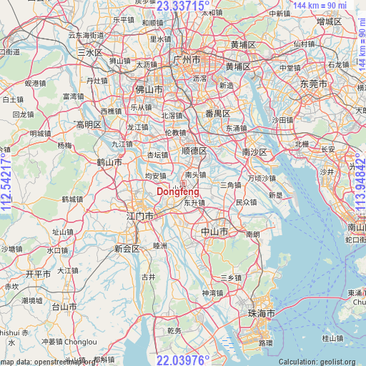
Dongfeng GPS coordinates[2]
22° 41' 23.964" North, 113° 14' 43.044" East
| Map corner | latitude | longitude |
|---|---|---|
| Upper-left | 23.33715°, | 112.54217° |
| Center: | 22.68999°, | 113.24529° |
| Lower-right: | 22.03976°, | 113.94842° |
| Map W x H: | 144.3×144.3 km | = 89.7×89.7mi |
| max Lat: | 53.31946° ⇑95.7% North |
| Dongfeng: | 22.68999° |
| min Lat: | ⇓4.3% South 18.22056° |
| min Long | Dongfeng | max Long |
| 75.07348° | 113.24529° | 134.28917° |
| W 44%⇐ | ⇒56% E |
Elevation
Elevation of Dongfeng is 5 m = 16 ft, and this is 479.8 m = 1574 ft below average elevation for this country.
| Max E: |
5622 m = 18445 ft | 97.2% |
| Avg. | 484.8 m = 1591 ft | |
| Dongfeng | 5 m = 16 ft | |
Min E: |
-3 m = -10 ft | 2.8% |
See also: China elevation on elevation.city.
Geographical zone
Dongfeng is located in North Torrid zone (between Equator and Tropic of Cancer). Distance of this Northern Tropic circle is 83 km =51.6 mi to North.| Distance of | km | miles | from Dongfeng |
|---|---|---|---|
| North Pole | 7484.2 | 4650.5 | to North |
| Arctic Circle | 4878.3 | 3031.2 | to North |
| Tropic Cancer | 83 | 51.6 | to North |
| Equator | 2522.9 | 1567.7 | to South |


Nearby cities:
15 places around Dongfeng: (largest is in red/bold)
• Chaolian
15.3 km =9.5 mi,  245°
245°
• Daliang
16.8 km =10.4 mi,  1°
1°
• Dongsheng
8.7 km =5.4 mi,  149°
149°
• Fusha
10.7 km =6.6 mi,  106°
106°
• Gangkou
17.3 km =10.7 mi,  130°
130°
• Guzhen
11 km =6.8 mi,  220°
220°
• Hetang
12.6 km =7.8 mi, 252°
• Huangpu
9.8 km =6.1 mi,  72°
72°
• Jun’an
10.3 km =6.4 mi,  279°
279°
• Nantou
6 km =3.7 mi,  53°
53°
• Ronggui
8.1 km =5 mi, 4°
• Shunde
13.2 km =8.2 mi,  21°
21°
• Waihai
14.5 km =9 mi, 224°
• Xiaolan
1.9 km =1.2 mi,  227°
227°
• Xingtan
14.7 km =9.1 mi,  315°
315°
Sources, notices
• [Note1] Compared only with cities in China existing in our database
• [Src1] Map data: © OpenStreetMap contributors (CC-BY-SA)
• [Src2] Other city data from geonames.org with taken over terms of usage.
• [Src3] Geographical zone / Annual Mean Temperature by Robert A. Rohde @ Wikipedia
