Xiasi geodata
Xiasi (Sichuan) is a seat of a third-order administrative division; located in China in Asia/Shanghai (GMT+8) time zone. In our database, there are 1268 cities with bigger population. Compared to other cities in China, 62.9% of cities are located further ↓South; 88.2% of cities are located further →East and 77.1% of cities have lower elevation than Xiasi. Note1


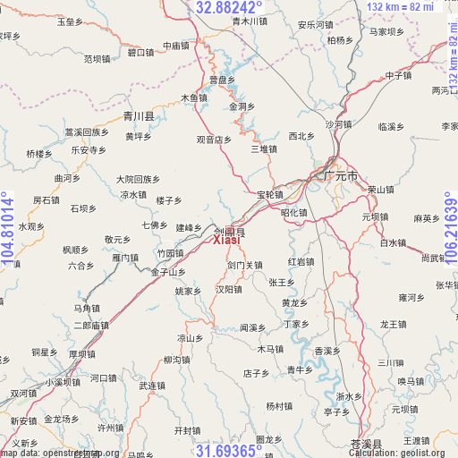
Xiasi GPS coordinates[2]
32° 17' 23.928" North, 105° 30' 47.736" East
| Map corner | latitude | longitude |
|---|---|---|
| Upper-left | 32.88242°, | 104.81014° |
| Center: | 32.28998°, | 105.51326° |
| Lower-right: | 31.69365°, | 106.21639° |
| Map W x H: | 132.2×132.2 km | = 82.1×82.1mi |
| max Lat: | 53.31946° ⇑37.1% North |
| Xiasi: | 32.28998° |
| min Lat: | ⇓62.9% South 18.22056° |
| min Long | Xiasi | max Long |
| 75.07348° | 105.51326° | 134.28917° |
| W 11.8%⇐ | ⇒88.2% E |
Elevation
Elevation of Xiasi is 578 m = 1896 ft, and this is 93.2 m = 306 ft above average elevation for this country.
| Max E: |
5622 m = 18445 ft | 22.9% |
| Xiasi | 578 m 1896 ft | |
| Avg. | 484.8 m = 1591 ft | |
Min E: |
-3 m = -10 ft | 77.1% |
See also: China elevation on elevation.city.
Geographical zone
Xiasi is located in North temperate zone (between Tropic of Cancer and the Arctic Circle). Distance of this Northern Tropic circle is 984.4 km =611.7 mi to South.| Distance of | km | miles | from Xiasi |
|---|---|---|---|
| North Pole | 6416.8 | 3987.2 | to North |
| Arctic Circle | 3810.9 | 2368 | to North |
| Tropic Cancer | 984.4 | 611.7 | to South |
| Equator | 3590.3 | 2230.9 | to South |


Nearby cities:
15 places around Xiasi: (largest is in red/bold)
• Baishui
47.4 km =29.5 mi,  94°
94°
• Banqiao
40.2 km =25 mi,  336°
336°
• Chaotian
52.6 km =32.7 mi,  41°
41°
• Dayuanhuizu
30.1 km =18.7 mi,  299°
299°
• Guangyuan
33.6 km =20.9 mi,  59°
59°
• Liangshui
29.6 km =18.4 mi,  290°
290°
• Linxi
55.5 km =34.5 mi, 57°
• Longwang
54.6 km =33.9 mi,  119°
119°
• Magong
45.4 km =28.2 mi,  275°
275°
• Pu’an
28.4 km =17.6 mi,  188°
188°
• Qiaozhuang
42.5 km =26.4 mi,  321°
321°
• Qifo
21.5 km =13.4 mi,  274°
274°
• Shazhou
42.3 km =26.3 mi,  356°
356°
• Suhe
33.1 km =20.6 mi, 282°
• Yuanba
42.3 km =26.3 mi,  84°
84°
Sources, notices
• [Note1] Compared only with cities in China existing in our database
• [Src1] Map data: © OpenStreetMap contributors (CC-BY-SA)
• [Src2] Other city data from geonames.org with taken over terms of usage.
• [Src3] Geographical zone / Annual Mean Temperature by Robert A. Rohde @ Wikipedia
