Yuanba geodata
Yuanba (Sichuan) is a seat of a third-order administrative division; located in China in Asia/Shanghai (GMT+8) time zone. In our database, there are 1268 cities with bigger population. Compared to other cities in China, 63.2% of cities are located further ↓South; 87% of cities are located further →East and 75.4% of cities have lower elevation than Yuanba. Note1


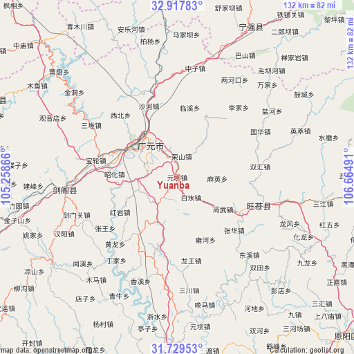
Yuanba GPS coordinates[2]
32° 19' 32.268" North, 105° 57' 42.408" East
| Map corner | latitude | longitude |
|---|---|---|
| Upper-left | 32.91783°, | 105.25866° |
| Center: | 32.32563°, | 105.96178° |
| Lower-right: | 31.72953°, | 106.66491° |
| Map W x H: | 132.1×132.1 km | = 82.1×82.1mi |
| max Lat: | 53.31946° ⇑36.8% North |
| Yuanba: | 32.32563° |
| min Lat: | ⇓63.2% South 18.22056° |
| min Long | Yuanba | max Long |
| 75.07348° | 105.96178° | 134.28917° |
| W 13%⇐ | ⇒87% E |
Elevation
Elevation of Yuanba is 530 m = 1739 ft, and this is 45.2 m = 148 ft above average elevation for this country.
| Max E: |
5622 m = 18445 ft | 24.6% |
| Yuanba | 530 m 1739 ft | |
| Avg. | 484.8 m = 1591 ft | |
Min E: |
-3 m = -10 ft | 75.4% |
See also: China elevation on elevation.city.
Geographical zone
Yuanba is located in North temperate zone (between Tropic of Cancer and the Arctic Circle). Distance of this Northern Tropic circle is 988.4 km =614.2 mi to South.| Distance of | km | miles | from Yuanba |
|---|---|---|---|
| North Pole | 6412.8 | 3984.7 | to North |
| Arctic Circle | 3806.9 | 2365.5 | to North |
| Tropic Cancer | 988.4 | 614.2 | to South |
| Equator | 3594.3 | 2233.4 | to South |


Nearby cities:
15 places around Yuanba: (largest is in red/bold)
• Baishui
9.1 km =5.7 mi,  145°
145°
• Chaotian
36.2 km =22.5 mi,  348°
348°
• Donghe
33.5 km =20.8 mi,  107°
107°
• Guangyuan
18.4 km =11.4 mi,  314°
314°
• Guohua
35.4 km =22 mi,  61°
61°
• Jiachuan
27.1 km =16.8 mi,  118°
118°
• Lijia
34.7 km =21.6 mi,  41°
41°
• Linxi
26.4 km =16.4 mi,  10°
10°
• Longwang
31.4 km =19.5 mi,  170°
170°
• Maliu
23.7 km =14.7 mi,  19°
19°
• Maying
15 km =9.3 mi,  91°
91°
• Shangwu
20.8 km =12.9 mi, 124°
• Wangjia
28.8 km =17.9 mi, 39°
• Zengjia
35.2 km =21.9 mi, 21°
• Zhanghua
28.8 km =17.9 mi,  133°
133°
Sources, notices
• [Note1] Compared only with cities in China existing in our database
• [Src1] Map data: © OpenStreetMap contributors (CC-BY-SA)
• [Src2] Other city data from geonames.org with taken over terms of usage.
• [Src3] Geographical zone / Annual Mean Temperature by Robert A. Rohde @ Wikipedia
