Dayuanhuizu geodata
Dayuanhuizu (Sichuan) is a seat of a fourth-order administrative division; located in China in Asia/Shanghai (GMT+8) time zone. In our database, there are 1268 cities with bigger population. Compared to other cities in China, 63.6% of cities are located further ↓South; 88.7% of cities are located further →East and 82.3% of cities have lower elevation than Dayuanhuizu. Note1


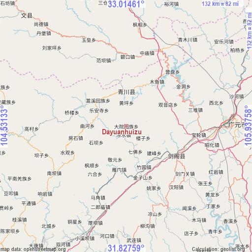
Dayuanhuizu GPS coordinates[2]
32° 25' 22.98" North, 105° 14' 4.02" East
| Map corner | latitude | longitude |
|---|---|---|
| Upper-left | 33.01461°, | 104.53133° |
| Center: | 32.42305°, | 105.23445° |
| Lower-right: | 31.82759°, | 105.93758° |
| Map W x H: | 132×132 km | = 82×82mi |
| max Lat: | 53.31946° ⇑36.4% North |
| Dayuanhuizu: | 32.42305° |
| min Lat: | ⇓63.6% South 18.22056° |
| min Long | Dayuanhuizu | max Long |
| 75.07348° | 105.23445° | 134.28917° |
| W 11.3%⇐ | ⇒88.7% E |
Elevation
Elevation of Dayuanhuizu is 806 m = 2644 ft, and this is 321.2 m = 1054 ft above average elevation for this country.
| Max E: |
5622 m = 18445 ft | 17.7% |
| Dayuanhuizu | 806 m 2644 ft | |
| Avg. | 484.8 m = 1591 ft | |
Min E: |
-3 m = -10 ft | 82.3% |
See also: China elevation on elevation.city.
Geographical zone
Dayuanhuizu is located in North temperate zone (between Tropic of Cancer and the Arctic Circle). Distance of this Northern Tropic circle is 999.2 km =620.9 mi to South.| Distance of | km | miles | from Dayuanhuizu |
|---|---|---|---|
| North Pole | 6402 | 3978 | to North |
| Arctic Circle | 3796.1 | 2358.8 | to North |
| Tropic Cancer | 999.2 | 620.9 | to South |
| Equator | 3605.1 | 2240.1 | to South |


Nearby cities:
15 places around Dayuanhuizu: (largest is in red/bold)
• Banqiao
24.5 km =15.2 mi,  25°
25°
• Caohe
58.5 km =36.4 mi,  345°
345°
• Chaotian
65.8 km =40.9 mi,  68°
68°
• Fengxiang
53.7 km =33.4 mi,  7°
7°
• Guangyuan
55.3 km =34.4 mi,  87°
87°
• Koutouba
63.7 km =39.6 mi,  334°
334°
• Liangshui
4.7 km =2.9 mi,  198°
198°
• Magong
21.7 km =13.5 mi,  240°
240°
• Pu’an
48.1 km =29.9 mi,  152°
152°
• Qiaozhuang
18.6 km =11.6 mi,  359°
359°
• Qifo
14.1 km =8.8 mi,  160°
160°
• Shazhou
36 km =22.4 mi,  40°
40°
• Suhe
9.8 km =6.1 mi,  218°
218°
• Weihe
64.2 km =39.9 mi, 7°
• Xiasi
30.1 km =18.7 mi,  119°
119°
Sources, notices
• [Note1] Compared only with cities in China existing in our database
• [Src1] Map data: © OpenStreetMap contributors (CC-BY-SA)
• [Src2] Other city data from geonames.org with taken over terms of usage.
• [Src3] Geographical zone / Annual Mean Temperature by Robert A. Rohde @ Wikipedia
