Huangbu geodata
Huangbu (Guangdong) is a seat of a fourth-order administrative division; located in China in Asia/Shanghai (GMT+8) time zone. In our database, there are 1268 cities with bigger population. Compared to other cities in China, 95.5% of cities are located further ↑North; 54% of cities are located further ←West and 91.2% of cities have higher elevation than Huangbu. Note1


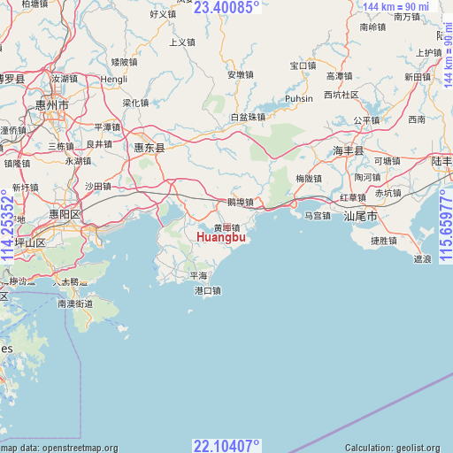
Huangbu GPS coordinates[2]
22° 45' 14.4" North, 114° 57' 23.904" East
| Map corner | latitude | longitude |
|---|---|---|
| Upper-left | 23.40085°, | 114.25352° |
| Center: | 22.754°, | 114.95664° |
| Lower-right: | 22.10407°, | 115.65977° |
| Map W x H: | 144.2×144.2 km | = 89.6×89.6mi |
| max Lat: | 53.31946° ⇑95.5% North |
| Huangbu: | 22.754° |
| min Lat: | ⇓4.5% South 18.22056° |
| min Long | Huangbu | max Long |
| 75.07348° | 114.95664° | 134.28917° |
| W 54%⇐ | ⇒46% E |
Elevation
Elevation of Huangbu is 9 m = 30 ft, and this is 475.8 m = 1561 ft below average elevation for this country.
| Max E: |
5622 m = 18445 ft | 91.2% |
| Avg. | 484.8 m = 1591 ft | |
| Huangbu | 9 m = 30 ft | |
Min E: |
-3 m = -10 ft | 8.8% |
See also: China elevation on elevation.city.
Geographical zone
Huangbu is located in North Torrid zone (between Equator and Tropic of Cancer). Distance of this Northern Tropic circle is 75.9 km =47.2 mi to North.| Distance of | km | miles | from Huangbu |
|---|---|---|---|
| North Pole | 7477.1 | 4646.1 | to North |
| Arctic Circle | 4871.2 | 3026.8 | to North |
| Tropic Cancer | 75.9 | 47.2 | to North |
| Equator | 2530 | 1572.1 | to South |


Nearby cities:
15 places around Huangbu: (largest is in red/bold)
• Chishi
18.1 km =11.2 mi,  43°
43°
• Duozhu
30.7 km =19.1 mi,  358°
358°
• Ebu
9.5 km =5.9 mi,  24°
24°
• Gangkou
20.8 km =12.9 mi,  196°
196°
• Houmen
21.3 km =13.2 mi,  71°
71°
• Jilong
6.6 km =4.1 mi,  321°
321°
• Magong
29.2 km =18.1 mi,  82°
82°
• Meilong
30.3 km =18.8 mi,  59°
59°
• Pinghai
17.5 km =10.9 mi,  209°
209°
• Renshan
18 km =11.2 mi,  300°
300°
• Tieyong
12.1 km =7.5 mi,  256°
256°
• Xiaomo
8.3 km =5.2 mi, 72°
• Xiayong
31.8 km =19.8 mi,  276°
276°
• Yanzhou
3.6 km =2.2 mi, 210°
• Zengguang
30.6 km =19 mi,  343°
343°
Sources, notices
• [Note1] Compared only with cities in China existing in our database
• [Src1] Map data: © OpenStreetMap contributors (CC-BY-SA)
• [Src2] Other city data from geonames.org with taken over terms of usage.
• [Src3] Geographical zone / Annual Mean Temperature by Robert A. Rohde @ Wikipedia
