Xiayong geodata
Xiayong (Guangdong) is a seat of a fourth-order administrative division; located in China in Asia/Shanghai (GMT+8) time zone. In our database, there are 1268 cities with bigger population. Compared to other cities in China, 95.3% of cities are located further ↑North; 52.3% of cities are located further ←West and 81.6% of cities have higher elevation than Xiayong. Note1


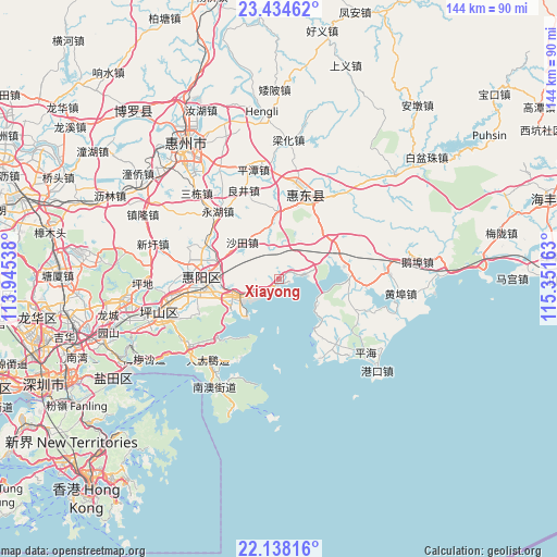
Xiayong GPS coordinates[2]
22° 47' 16.548" North, 114° 38' 54.6" East
| Map corner | latitude | longitude |
|---|---|---|
| Upper-left | 23.43462°, | 113.94538° |
| Center: | 22.78793°, | 114.6485° |
| Lower-right: | 22.13816°, | 115.35163° |
| Map W x H: | 144.2×144.2 km | = 89.6×89.6mi |
| max Lat: | 53.31946° ⇑95.3% North |
| Xiayong: | 22.78793° |
| min Lat: | ⇓4.7% South 18.22056° |
| min Long | Xiayong | max Long |
| 75.07348° | 114.6485° | 134.28917° |
| W 52.3%⇐ | ⇒47.7% E |
Elevation
Elevation of Xiayong is 23 m = 75 ft, and this is 461.8 m = 1515 ft below average elevation for this country.
| Max E: |
5622 m = 18445 ft | 81.6% |
| Avg. | 484.8 m = 1591 ft | |
| Xiayong | 23 m = 75 ft | |
Min E: |
-3 m = -10 ft | 18.4% |
See also: China elevation on elevation.city.
Geographical zone
Xiayong is located in North Torrid zone (between Equator and Tropic of Cancer). Distance of this Northern Tropic circle is 72.1 km =44.8 mi to North.| Distance of | km | miles | from Xiayong |
|---|---|---|---|
| North Pole | 7473.3 | 4643.7 | to North |
| Arctic Circle | 4867.4 | 3024.5 | to North |
| Tropic Cancer | 72.1 | 44.8 | to North |
| Equator | 2533.8 | 1574.4 | to South |


Nearby cities:
15 places around Xiayong: (largest is in red/bold)
• Aotou
13.5 km =8.4 mi,  239°
239°
• Baihua
18.6 km =11.6 mi,  0°
0°
• Daling
25.8 km =16 mi,  10°
10°
• Danshui
18.6 km =11.6 mi,  273°
273°
• Dapeng
27.5 km =17.1 mi,  220°
220°
• Jilong
27.5 km =17.1 mi,  87°
87°
• Kengzi
28.8 km =17.9 mi,  262°
262°
• Kuiyong
29.1 km =18.1 mi, 235°
• Liangjing
25.4 km =15.8 mi,  340°
340°
• Pingshan
23.8 km =14.8 mi,  16°
16°
• Qiuchang
23.4 km =14.5 mi,  278°
278°
• Renshan
16.9 km =10.5 mi,  71°
71°
• Shatian
14 km =8.7 mi,  314°
314°
• Tieyong
20.9 km =13 mi,  108°
108°
• Yonghu
24.5 km =15.2 mi,  317°
317°
Sources, notices
• [Note1] Compared only with cities in China existing in our database
• [Src1] Map data: © OpenStreetMap contributors (CC-BY-SA)
• [Src2] Other city data from geonames.org with taken over terms of usage.
• [Src3] Geographical zone / Annual Mean Temperature by Robert A. Rohde @ Wikipedia
