Tangbao geodata
Tangbao (Fujian) is a seat of a fourth-order administrative division; located in China in Asia/Shanghai (GMT+8) time zone. In our database, there are 1268 cities with bigger population. Compared to other cities in China, 86.9% of cities are located further ↑North; 65% of cities are located further ←West and 62.3% of cities have lower elevation than Tangbao. Note1


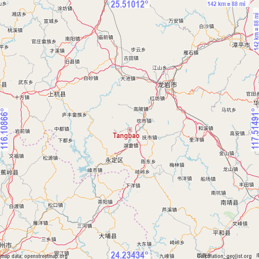
Tangbao GPS coordinates[2]
24° 52' 25.968" North, 116° 48' 42.408" East
| Map corner | latitude | longitude |
|---|---|---|
| Upper-left | 25.51012°, | 116.10866° |
| Center: | 24.87388°, | 116.81178° |
| Lower-right: | 24.23434°, | 117.51491° |
| Map W x H: | 141.9×141.9 km | = 88.2×88.2mi |
| max Lat: | 53.31946° ⇑86.9% North |
| Tangbao: | 24.87388° |
| min Lat: | ⇓13.1% South 18.22056° |
| min Long | Tangbao | max Long |
| 75.07348° | 116.81178° | 134.28917° |
| W 65%⇐ | ⇒35% E |
Elevation
Elevation of Tangbao is 287 m = 942 ft, and this is 197.8 m = 649 ft below average elevation for this country.
| Max E: |
5622 m = 18445 ft | 37.7% |
| Avg. | 484.8 m = 1591 ft | |
| Tangbao | 287 m = 942 ft | |
Min E: |
-3 m = -10 ft | 62.3% |
See also: China elevation on elevation.city.
Geographical zone
Tangbao is located in North temperate zone (between Tropic of Cancer and the Arctic Circle). Distance of this Northern Tropic circle is 159.8 km =99.3 mi to South.| Distance of | km | miles | from Tangbao |
|---|---|---|---|
| North Pole | 7241.3 | 4499.5 | to North |
| Arctic Circle | 4635.5 | 2880.4 | to North |
| Tropic Cancer | 159.8 | 99.3 | to South |
| Equator | 2765.7 | 1718.5 | to South |


Nearby cities:
15 places around Tangbao: (largest is in red/bold)
• Chendong
19.8 km =12.3 mi,  149°
149°
• Chengjiao
19.2 km =11.9 mi,  209°
209°
• Fengcheng
18.9 km =11.7 mi, 207°
• Fushi
11.5 km =7.1 mi,  110°
110°
• Gaobei
13.1 km =8.1 mi,  27°
27°
• Hexi
8.9 km =5.5 mi,  274°
274°
• Hugang
13.8 km =8.6 mi,  352°
352°
• Hulei
8.8 km =5.5 mi,  177°
177°
• Jinsha
19 km =11.8 mi,  222°
222°
• Kanshi
9.2 km =5.7 mi,  57°
57°
• Lanxi
20.2 km =12.6 mi,  282°
282°
• Peifeng
13.4 km =8.3 mi,  74°
74°
• Rentian
21.6 km =13.4 mi,  263°
263°
• Taiba
21.7 km =13.5 mi,  304°
304°
• Xixi
13.1 km =8.1 mi, 217°
Sources, notices
• [Note1] Compared only with cities in China existing in our database
• [Src1] Map data: © OpenStreetMap contributors (CC-BY-SA)
• [Src2] Other city data from geonames.org with taken over terms of usage.
• [Src3] Geographical zone / Annual Mean Temperature by Robert A. Rohde @ Wikipedia
