Fangjun geodata
Fangjun (Zhejiang) is a seat of a fourth-order administrative division; located in China in Asia/Shanghai (GMT+8) time zone. In our database, there are 1268 cities with bigger population. Compared to other cities in China, 64.6% of cities are located further ↑North; 83.5% of cities are located further ←West and 58.5% of cities have higher elevation than Fangjun. Note1


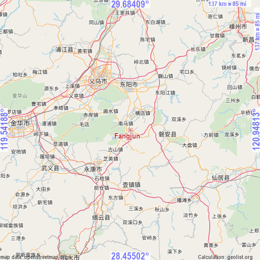
Fangjun GPS coordinates[2]
29° 4' 17.004" North, 120° 14' 42" East
| Map corner | latitude | longitude |
|---|---|---|
| Upper-left | 29.68409°, | 119.54188° |
| Center: | 29.07139°, | 120.245° |
| Lower-right: | 28.45502°, | 120.94813° |
| Map W x H: | 136.7×136.7 km | = 84.9×84.9mi |
| max Lat: | 53.31946° ⇑64.6% North |
| Fangjun: | 29.07139° |
| min Lat: | ⇓35.4% South 18.22056° |
| min Long | Fangjun | max Long |
| 75.07348° | 120.245° | 134.28917° |
| W 83.5%⇐ | ⇒16.5% E |
Elevation
Elevation of Fangjun is 108 m = 354 ft, and this is 376.8 m = 1236 ft below average elevation for this country.
| Max E: |
5622 m = 18445 ft | 58.5% |
| Avg. | 484.8 m = 1591 ft | |
| Fangjun | 108 m = 354 ft | |
Min E: |
-3 m = -10 ft | 41.5% |
See also: China elevation on elevation.city.
Geographical zone
Fangjun is located in North temperate zone (between Tropic of Cancer and the Arctic Circle). Distance of this Northern Tropic circle is 626.5 km =389.3 mi to South.| Distance of | km | miles | from Fangjun |
|---|---|---|---|
| North Pole | 6774.6 | 4209.5 | to North |
| Arctic Circle | 4168.7 | 2590.3 | to North |
| Tropic Cancer | 626.5 | 389.3 | to South |
| Equator | 3232.4 | 2008.5 | to South |


Nearby cities:
15 places around Fangjun: (largest is in red/bold)
• Baizhu
18.4 km =11.4 mi,  167°
167°
• Fangyan
15.8 km =9.8 mi,  200°
200°
• Gushan
12.6 km =7.8 mi,  218°
218°
• Hengdian
11.7 km =7.3 mi,  35°
35°
• Huangtianfan
15 km =9.3 mi,  315°
315°
• Huaxi
16.1 km =10 mi,  328°
328°
• Huxi
18.6 km =11.6 mi,  49°
49°
• Longshan
8.1 km =5 mi,  228°
228°
• Mazhai
12 km =7.5 mi,  78°
78°
• Nanshi
8.7 km =5.4 mi,  350°
350°
• Qianxiang
7.4 km =4.6 mi,  115°
115°
• Quanfu
4.3 km =2.7 mi, 326°
• Sanlian
10.3 km =6.4 mi,  108°
108°
• Xiangzhu
18.3 km =11.4 mi,  240°
240°
• Zhiying
18.1 km =11.2 mi, 220°
Sources, notices
• [Note1] Compared only with cities in China existing in our database
• [Src1] Map data: © OpenStreetMap contributors (CC-BY-SA)
• [Src2] Other city data from geonames.org with taken over terms of usage.
• [Src3] Geographical zone / Annual Mean Temperature by Robert A. Rohde @ Wikipedia
