Changtang geodata
Changtang (Zhejiang) is a seat of a fourth-order administrative division; located in China in Asia/Shanghai (GMT+8) time zone. In our database, there are 1268 cities with bigger population. Compared to other cities in China, 54.5% of cities are located further ↑North; 86.8% of cities are located further ←West and 88.7% of cities have higher elevation than Changtang. Note1


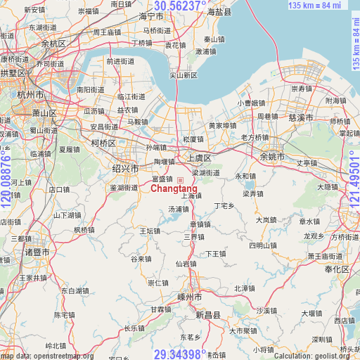
Changtang GPS coordinates[2]
29° 57' 18.144" North, 120° 47' 30.768" East
| Map corner | latitude | longitude |
|---|---|---|
| Upper-left | 30.56237°, | 120.08876° |
| Center: | 29.95504°, | 120.79188° |
| Lower-right: | 29.34398°, | 121.49501° |
| Map W x H: | 135.5×135.5 km | = 84.2×84.2mi |
| max Lat: | 53.31946° ⇑54.5% North |
| Changtang: | 29.95504° |
| min Lat: | ⇓45.5% South 18.22056° |
| min Long | Changtang | max Long |
| 75.07348° | 120.79188° | 134.28917° |
| W 86.8%⇐ | ⇒13.2% E |
Elevation
Elevation of Changtang is 11 m = 36 ft, and this is 473.8 m = 1554 ft below average elevation for this country.
| Max E: |
5622 m = 18445 ft | 88.7% |
| Avg. | 484.8 m = 1591 ft | |
| Changtang | 11 m = 36 ft | |
Min E: |
-3 m = -10 ft | 11.3% |
See also: China elevation on elevation.city.
Geographical zone
Changtang is located in North temperate zone (between Tropic of Cancer and the Arctic Circle). Distance of this Northern Tropic circle is 724.8 km =450.4 mi to South.| Distance of | km | miles | from Changtang |
|---|---|---|---|
| North Pole | 6676.4 | 4148.5 | to North |
| Arctic Circle | 4070.5 | 2529.3 | to North |
| Tropic Cancer | 724.8 | 450.4 | to South |
| Equator | 3330.7 | 2069.6 | to South |


Nearby cities:
15 places around Changtang: (largest is in red/bold)
• Daoxu
10.4 km =6.5 mi,  347°
347°
• Dongguan
6.6 km =4.1 mi,  18°
18°
• Fenghui
17.8 km =11.1 mi,  92°
92°
• Fusheng
7 km =4.3 mi,  277°
277°
• Gaobu
13.7 km =8.5 mi,  296°
296°
• Haoba
5.4 km =3.4 mi, 89°
• Lianghu
11 km =6.8 mi,  68°
68°
• Pingshui
18 km =11.2 mi,  247°
247°
• Shangpu
6.5 km =4 mi,  144°
144°
• Shangyu
10.2 km =6.3 mi,  48°
48°
• Songxia
16.6 km =10.3 mi, 16°
• Sunduan
15.7 km =9.8 mi,  324°
324°
• Tangpu
10.5 km =6.5 mi,  184°
184°
• Taoyan
9.6 km =6 mi, 320°
• Zhangzhen
17.8 km =11.1 mi,  155°
155°
Sources, notices
• [Note1] Compared only with cities in China existing in our database
• [Src1] Map data: © OpenStreetMap contributors (CC-BY-SA)
• [Src2] Other city data from geonames.org with taken over terms of usage.
• [Src3] Geographical zone / Annual Mean Temperature by Robert A. Rohde @ Wikipedia
