Yao’an geodata
Yao’an (Guangdong) is a seat of a fourth-order administrative division; located in China in Asia/Shanghai (GMT+8) time zone. In our database, there are 1268 cities with bigger population. Compared to other cities in China, 86.3% of cities are located further ↑North; 60.6% of cities are located further →East and 53.1% of cities have lower elevation than Yao’an. Note1


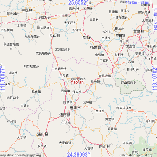
Yao’an GPS coordinates[2]
25° 1' 10.992" North, 112° 24' 14.004" East
| Map corner | latitude | longitude |
|---|---|---|
| Upper-left | 25.6552°, | 111.70077° |
| Center: | 25.01972°, | 112.40389° |
| Lower-right: | 24.38093°, | 113.10702° |
| Map W x H: | 141.7×141.7 km | = 88×88mi |
| max Lat: | 53.31946° ⇑86.3% North |
| Yao’an: | 25.01972° |
| min Lat: | ⇓13.7% South 18.22056° |
| min Long | Yao’an | max Long |
| 75.07348° | 112.40389° | 134.28917° |
| W 39.4%⇐ | ⇒60.6% E |
Elevation
Elevation of Yao’an is 189 m = 620 ft, and this is 295.8 m = 970 ft below average elevation for this country.
| Max E: |
5622 m = 18445 ft | 46.9% |
| Avg. | 484.8 m = 1591 ft | |
| Yao’an | 189 m = 620 ft | |
Min E: |
-3 m = -10 ft | 53.1% |
See also: China elevation on elevation.city.
Geographical zone
Yao’an is located in North temperate zone (between Tropic of Cancer and the Arctic Circle). Distance of this Northern Tropic circle is 176 km =109.4 mi to South.| Distance of | km | miles | from Yao’an |
|---|---|---|---|
| North Pole | 7225.1 | 4489.5 | to North |
| Arctic Circle | 4619.2 | 2870.2 | to North |
| Tropic Cancer | 176 | 109.4 | to South |
| Equator | 2781.9 | 1728.6 | to South |


Nearby cities:
15 places around Yao’an: (largest is in red/bold)
• Bao’an
11.5 km =7.1 mi,  188°
188°
• Dalubian
21.8 km =13.5 mi,  87°
87°
• Daqiao
31.5 km =19.6 mi,  289°
289°
• Dongbei
11.3 km =7 mi,  254°
254°
• Fengyang
13.6 km =8.5 mi,  284°
284°
• Jiangdong
30.1 km =18.7 mi,  331°
331°
• Lianzhou
26.7 km =16.6 mi, 187°
• Linwu Chengguanzhen
27.3 km =17 mi,  30°
30°
• Longping
23.3 km =14.5 mi,  161°
161°
• Sanjiang
35 km =21.7 mi,  198°
198°
• Sanshui
19.6 km =12.2 mi,  297°
297°
• Shantang
20.6 km =12.8 mi,  72°
72°
• Xijiang
34.6 km =21.5 mi,  148°
148°
• Xingzi
14.9 km =9.3 mi,  98°
98°
• Xi’an
16 km =9.9 mi,  226°
226°
Sources, notices
• [Note1] Compared only with cities in China existing in our database
• [Src1] Map data: © OpenStreetMap contributors (CC-BY-SA)
• [Src2] Other city data from geonames.org with taken over terms of usage.
• [Src3] Geographical zone / Annual Mean Temperature by Robert A. Rohde @ Wikipedia
