Baohedi geodata
Baohedi (Hunan) is a seat of a fourth-order administrative division; located in China in Asia/Shanghai (GMT+8) time zone. In our database, there are 1268 cities with bigger population. Compared to other cities in China, 60.8% of cities are located further ↑North; 62.8% of cities are located further →East and 75.7% of cities have higher elevation than Baohedi. Note1


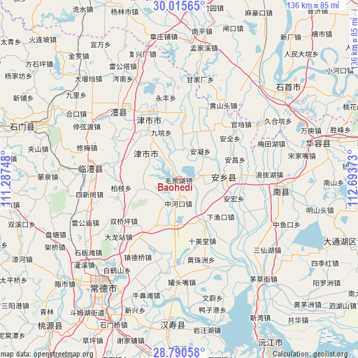
Baohedi GPS coordinates[2]
29° 24' 17.856" North, 111° 59' 26.16" East
| Map corner | latitude | longitude |
|---|---|---|
| Upper-left | 30.01565°, | 111.28748° |
| Center: | 29.40496°, | 111.9906° |
| Lower-right: | 28.79058°, | 112.69373° |
| Map W x H: | 136.2×136.2 km | = 84.6×84.6mi |
| max Lat: | 53.31946° ⇑60.8% North |
| Baohedi: | 29.40496° |
| min Lat: | ⇓39.2% South 18.22056° |
| min Long | Baohedi | max Long |
| 75.07348° | 111.9906° | 134.28917° |
| W 37.2%⇐ | ⇒62.8% E |
Elevation
Elevation of Baohedi is 35 m = 115 ft, and this is 449.8 m = 1476 ft below average elevation for this country.
| Max E: |
5622 m = 18445 ft | 75.7% |
| Avg. | 484.8 m = 1591 ft | |
| Baohedi | 35 m = 115 ft | |
Min E: |
-3 m = -10 ft | 24.3% |
See also: China elevation on elevation.city.
Geographical zone
Baohedi is located in North temperate zone (between Tropic of Cancer and the Arctic Circle). Distance of this Northern Tropic circle is 663.6 km =412.3 mi to South.| Distance of | km | miles | from Baohedi |
|---|---|---|---|
| North Pole | 6737.5 | 4186.5 | to North |
| Arctic Circle | 4131.6 | 2567.3 | to North |
| Tropic Cancer | 663.6 | 412.3 | to South |
| Equator | 3269.5 | 2031.6 | to South |


Nearby cities:
15 places around Baohedi: (largest is in red/bold)
• Anfeng
7.5 km =4.7 mi,  79°
79°
• Anning
13.4 km =8.3 mi,  36°
36°
• Anxiang
15.5 km =9.6 mi,  92°
92°
• Anyu
10.3 km =6.4 mi,  108°
108°
• Baiyi
12.7 km =7.9 mi,  296°
296°
• Dukou
10 km =6.2 mi,  212°
212°
• Guanyuan
17.2 km =10.7 mi,  6°
6°
• Haozigang
16.1 km =10 mi,  156°
156°
• Jiuyuan
19.2 km =11.9 mi,  339°
339°
• Lijiapu
12.3 km =7.6 mi,  326°
326°
• Lingquan
21.2 km =13.2 mi,  310°
310°
• Tanghua
12.7 km =7.9 mi,  252°
252°
• Xinzhou
19.8 km =12.3 mi, 327°
• Zhonghekou
9.3 km =5.8 mi,  181°
181°
• Zhoujiadian
19.5 km =12.1 mi, 206°
Sources, notices
• [Note1] Compared only with cities in China existing in our database
• [Src1] Map data: © OpenStreetMap contributors (CC-BY-SA)
• [Src2] Other city data from geonames.org with taken over terms of usage.
• [Src3] Geographical zone / Annual Mean Temperature by Robert A. Rohde @ Wikipedia
