Haoping geodata
Haoping (Hunan) is a seat of a fourth-order administrative division; located in China in Asia/Shanghai (GMT+8) time zone. In our database, there are 1268 cities with bigger population. Compared to other cities in China, 62.3% of cities are located further ↑North; 66% of cities are located further →East and 59.2% of cities have higher elevation than Haoping. Note1


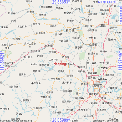
Haoping GPS coordinates[2]
29° 16' 30.18" North, 111° 16' 16.788" East
| Map corner | latitude | longitude |
|---|---|---|
| Upper-left | 29.88653°, | 110.56821° |
| Center: | 29.27505°, | 111.27133° |
| Lower-right: | 28.65989°, | 111.97446° |
| Map W x H: | 136.4×136.4 km | = 84.8×84.8mi |
| max Lat: | 53.31946° ⇑62.3% North |
| Haoping: | 29.27505° |
| min Lat: | ⇓37.7% South 18.22056° |
| min Long | Haoping | max Long |
| 75.07348° | 111.27133° | 134.28917° |
| W 34%⇐ | ⇒66% E |
Elevation
Elevation of Haoping is 103 m = 338 ft, and this is 381.8 m = 1253 ft below average elevation for this country.
| Max E: |
5622 m = 18445 ft | 59.2% |
| Avg. | 484.8 m = 1591 ft | |
| Haoping | 103 m = 338 ft | |
Min E: |
-3 m = -10 ft | 40.8% |
See also: China elevation on elevation.city.
Geographical zone
Haoping is located in North temperate zone (between Tropic of Cancer and the Arctic Circle). Distance of this Northern Tropic circle is 649.2 km =403.4 mi to South.| Distance of | km | miles | from Haoping |
|---|---|---|---|
| North Pole | 6752 | 4195.5 | to North |
| Arctic Circle | 4146.1 | 2576.3 | to North |
| Tropic Cancer | 649.2 | 403.4 | to South |
| Equator | 3255.1 | 2022.6 | to South |


Nearby cities:
15 places around Haoping: (largest is in red/bold)
• Cili
22.2 km =13.8 mi,  318°
318°
• Erfangping
7.7 km =4.8 mi,  281°
281°
• Guangfuqiao
22.6 km =14 mi,  6°
6°
• Huangjiapu
18.1 km =11.2 mi,  174°
174°
• Huangshi
12.7 km =7.9 mi,  215°
215°
• Jinglongqiao
17.2 km =10.7 mi, 280°
• Jiuxi
10.5 km =6.5 mi,  179°
179°
• Ligonggang
21.1 km =13.1 mi,  198°
198°
• Lingxi
14.2 km =8.8 mi, 318°
• Longtanhe
19.3 km =12 mi,  259°
259°
• Mazongling
18.3 km =11.4 mi,  102°
102°
• Pantang
23.7 km =14.7 mi,  106°
106°
• Qihe
18.8 km =11.7 mi,  147°
147°
• Reshi
7.2 km =4.5 mi,  43°
43°
• Shuangxikou
9.7 km =6 mi, 106°
Sources, notices
• [Note1] Compared only with cities in China existing in our database
• [Src1] Map data: © OpenStreetMap contributors (CC-BY-SA)
• [Src2] Other city data from geonames.org with taken over terms of usage.
• [Src3] Geographical zone / Annual Mean Temperature by Robert A. Rohde @ Wikipedia
