Ligonggang geodata
Ligonggang (Hunan) is a seat of a fourth-order administrative division; located in China in Asia/Shanghai (GMT+8) time zone. In our database, there are 1268 cities with bigger population. Compared to other cities in China, 64.3% of cities are located further ↑North; 66.3% of cities are located further →East and 64.9% of cities have higher elevation than Ligonggang. Note1


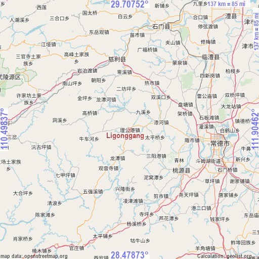
Ligonggang GPS coordinates[2]
29° 5' 41.856" North, 111° 12' 5.364" East
| Map corner | latitude | longitude |
|---|---|---|
| Upper-left | 29.70752°, | 110.49837° |
| Center: | 29.09496°, | 111.20149° |
| Lower-right: | 28.47873°, | 111.90462° |
| Map W x H: | 136.6×136.6 km | = 84.9×84.9mi |
| max Lat: | 53.31946° ⇑64.3% North |
| Ligonggang: | 29.09496° |
| min Lat: | ⇓35.7% South 18.22056° |
| min Long | Ligonggang | max Long |
| 75.07348° | 111.20149° | 134.28917° |
| W 33.7%⇐ | ⇒66.3% E |
Elevation
Elevation of Ligonggang is 73 m = 240 ft, and this is 411.8 m = 1351 ft below average elevation for this country.
| Max E: |
5622 m = 18445 ft | 64.9% |
| Avg. | 484.8 m = 1591 ft | |
| Ligonggang | 73 m = 240 ft | |
Min E: |
-3 m = -10 ft | 35.1% |
See also: China elevation on elevation.city.
Geographical zone
Ligonggang is located in North temperate zone (between Tropic of Cancer and the Arctic Circle). Distance of this Northern Tropic circle is 629.1 km =390.9 mi to South.| Distance of | km | miles | from Ligonggang |
|---|---|---|---|
| North Pole | 6772 | 4207.9 | to North |
| Arctic Circle | 4166.1 | 2588.7 | to North |
| Tropic Cancer | 629.1 | 390.9 | to South |
| Equator | 3235.1 | 2010.2 | to South |


Nearby cities:
15 places around Ligonggang: (largest is in red/bold)
• Erfangping
21.5 km =13.4 mi,  358°
358°
• Gaoqiao
22.6 km =14 mi,  293°
293°
• Haoping
21.1 km =13.1 mi,  18°
18°
• Huangjiapu
8.6 km =5.3 mi,  76°
76°
• Huangshi
9.7 km =6 mi, 356°
• Jiuxi
11.8 km =7.3 mi,  35°
35°
• Longtan
16.3 km =10.1 mi,  204°
204°
• Longtanhe
20.5 km =12.7 mi,  323°
323°
• Niuchehe
22.6 km =14 mi,  256°
256°
• Qihe
17.4 km =10.8 mi, 76°
• Sanyanggang
19.3 km =12 mi,  133°
133°
• Shejiaping
14 km =8.7 mi,  159°
159°
• Taipingqiao
13.7 km =8.5 mi,  105°
105°
• Wuxihe
22.2 km =13.8 mi, 111°
• Zhongjiapu
14.7 km =9.1 mi,  267°
267°
Sources, notices
• [Note1] Compared only with cities in China existing in our database
• [Src1] Map data: © OpenStreetMap contributors (CC-BY-SA)
• [Src2] Other city data from geonames.org with taken over terms of usage.
• [Src3] Geographical zone / Annual Mean Temperature by Robert A. Rohde @ Wikipedia
