Meihua geodata
Meihua (Hunan) is a seat of a fourth-order administrative division; located in China in Asia/Shanghai (GMT+8) time zone. In our database, there are 1268 cities with bigger population. Compared to other cities in China, 67.9% of cities are located further ↑North; 73% of cities are located further →East and 65.4% of cities have lower elevation than Meihua. Note1


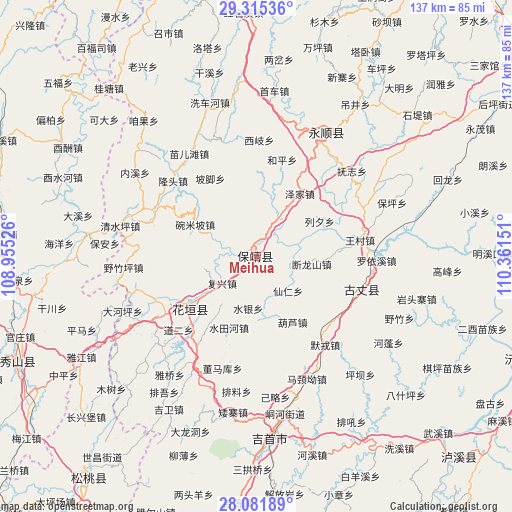
Meihua GPS coordinates[2]
28° 42' 1.584" North, 109° 39' 30.168" East
| Map corner | latitude | longitude |
|---|---|---|
| Upper-left | 29.31536°, | 108.95526° |
| Center: | 28.70044°, | 109.65838° |
| Lower-right: | 28.08189°, | 110.36151° |
| Map W x H: | 137.1×137.1 km | = 85.2×85.2mi |
| max Lat: | 53.31946° ⇑67.9% North |
| Meihua: | 28.70044° |
| min Lat: | ⇓32.1% South 18.22056° |
| min Long | Meihua | max Long |
| 75.07348° | 109.65838° | 134.28917° |
| W 27%⇐ | ⇒73% E |
Elevation
Elevation of Meihua is 333 m = 1093 ft, and this is 151.8 m = 498 ft below average elevation for this country.
| Max E: |
5622 m = 18445 ft | 34.6% |
| Avg. | 484.8 m = 1591 ft | |
| Meihua | 333 m = 1093 ft | |
Min E: |
-3 m = -10 ft | 65.4% |
See also: China elevation on elevation.city.
Geographical zone
Meihua is located in North temperate zone (between Tropic of Cancer and the Arctic Circle). Distance of this Northern Tropic circle is 585.3 km =363.7 mi to South.| Distance of | km | miles | from Meihua |
|---|---|---|---|
| North Pole | 6815.9 | 4235.2 | to North |
| Arctic Circle | 4210 | 2616 | to North |
| Tropic Cancer | 585.3 | 363.7 | to South |
| Equator | 3191.2 | 1982.9 | to South |


Nearby cities:
15 places around Meihua: (largest is in red/bold)
• Angdong
10.7 km =6.6 mi,  315°
315°
• Baiyang
14 km =8.7 mi,  31°
31°
• Bamao
18.1 km =11.2 mi,  293°
293°
• Datuo
18.9 km =11.7 mi,  261°
261°
• Duanlongshan
15 km =9.3 mi,  97°
97°
• Fuxing
11.6 km =7.2 mi,  232°
232°
• Hulu
20 km =12.4 mi,  150°
150°
• Liexi
19.5 km =12.1 mi,  60°
60°
• Longxi
4.5 km =2.8 mi,  10°
10°
• Purong
18.1 km =11.2 mi,  346°
346°
• Qianling
1.8 km =1.1 mi, 316°
• Shuiyin
14 km =8.7 mi,  189°
189°
• Tuzha
13.6 km =8.5 mi,  165°
165°
• Xianren
12.4 km =7.7 mi,  136°
136°
• Yangchao
5.6 km =3.5 mi, 135°
Sources, notices
• [Note1] Compared only with cities in China existing in our database
• [Src1] Map data: © OpenStreetMap contributors (CC-BY-SA)
• [Src2] Other city data from geonames.org with taken over terms of usage.
• [Src3] Geographical zone / Annual Mean Temperature by Robert A. Rohde @ Wikipedia
