Jiangkou geodata
Jiangkou (Hunan) is a seat of a fourth-order administrative division; located in China in Asia/Shanghai (GMT+8) time zone. In our database, there are 1268 cities with bigger population. Compared to other cities in China, 79.9% of cities are located further ↑North; 52.6% of cities are located further →East and 53.1% of cities have lower elevation than Jiangkou. Note1


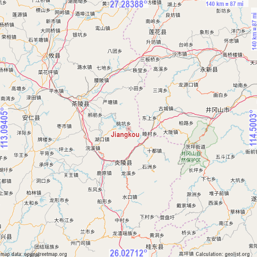
Jiangkou GPS coordinates[2]
26° 39' 26.028" North, 113° 47' 49.812" East
| Map corner | latitude | longitude |
|---|---|---|
| Upper-left | 27.28388°, | 113.09405° |
| Center: | 26.65723°, | 113.79717° |
| Lower-right: | 26.02712°, | 114.5003° |
| Map W x H: | 139.7×139.7 km | = 86.8×86.8mi |
| max Lat: | 53.31946° ⇑79.9% North |
| Jiangkou: | 26.65723° |
| min Lat: | ⇓20.1% South 18.22056° |
| min Long | Jiangkou | max Long |
| 75.07348° | 113.79717° | 134.28917° |
| W 47.4%⇐ | ⇒52.6% E |
Elevation
Elevation of Jiangkou is 189 m = 620 ft, and this is 295.8 m = 970 ft below average elevation for this country.
| Max E: |
5622 m = 18445 ft | 46.9% |
| Avg. | 484.8 m = 1591 ft | |
| Jiangkou | 189 m = 620 ft | |
Min E: |
-3 m = -10 ft | 53.1% |
See also: China elevation on elevation.city.
Geographical zone
Jiangkou is located in North temperate zone (between Tropic of Cancer and the Arctic Circle). Distance of this Northern Tropic circle is 358.1 km =222.5 mi to South.| Distance of | km | miles | from Jiangkou |
|---|---|---|---|
| North Pole | 7043.1 | 4376.4 | to North |
| Arctic Circle | 4437.2 | 2757.1 | to North |
| Tropic Cancer | 358.1 | 222.5 | to South |
| Equator | 2964 | 1841.7 | to South |


Nearby cities:
15 places around Jiangkou: (largest is in red/bold)
• Chaling Chengguanzhen
29.6 km =18.4 mi,  300°
300°
• Huanxi
22.1 km =13.7 mi,  241°
241°
• Hukou
15.5 km =9.6 mi,  248°
248°
• Lingfang
19.7 km =12.2 mi,  292°
292°
• Majiang
26.3 km =16.3 mi,  283°
283°
• Mijiang
28.3 km =17.6 mi, 302°
• Sicong
30.6 km =19 mi, 304°
• Taokeng
4.9 km =3 mi, 283°
• Xiadong
29.4 km =18.3 mi, 296°
• Xiaotian
22.4 km =13.9 mi,  10°
10°
• Xiayang
18.9 km =11.7 mi,  188°
188°
• Yantang
17.7 km =11 mi,  325°
325°
• Yaopi
30.3 km =18.8 mi, 330°
• Yaoshui
21.8 km =13.5 mi, 329°
• Zhitang
32.4 km =20.1 mi, 11°
Sources, notices
• [Note1] Compared only with cities in China existing in our database
• [Src1] Map data: © OpenStreetMap contributors (CC-BY-SA)
• [Src2] Other city data from geonames.org with taken over terms of usage.
• [Src3] Geographical zone / Annual Mean Temperature by Robert A. Rohde @ Wikipedia
