Hongtang geodata
Hongtang (Fujian) is a populated place; located in China in Asia/Shanghai (GMT+8) time zone. With population of 1,060 people, there are 1165 cities with bigger population in this country. Compared to other cities in China, 82.1% of cities are located further ↑North; 77.2% of cities are located further ←West and 85.5% of cities have higher elevation than Hongtang. Note1


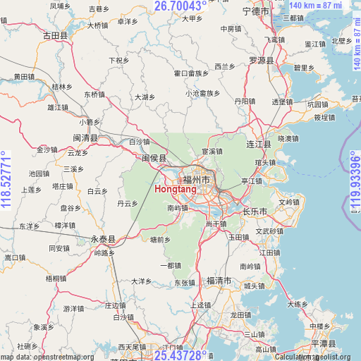
Hongtang GPS coordinates[2]
26° 4' 14.016" North, 119° 13' 50.988" East
| Map corner | latitude | longitude |
|---|---|---|
| Upper-left | 26.70043°, | 118.52771° |
| Center: | 26.07056°, | 119.23083° |
| Lower-right: | 25.43728°, | 119.93396° |
| Map W x H: | 140.4×140.5 km | = 87.2×87.3mi |
| max Lat: | 53.31946° ⇑82.1% North |
| Hongtang: | 26.07056° |
| min Lat: | ⇓17.9% South 18.22056° |
| min Long | Hongtang | max Long |
| 75.07348° | 119.23083° | 134.28917° |
| W 77.2%⇐ | ⇒22.8% E |
Elevation
Elevation of Hongtang is 15 m = 49 ft, and this is 469.8 m = 1541 ft below average elevation for this country.
| Max E: |
5622 m = 18445 ft | 85.5% |
| Avg. | 484.8 m = 1591 ft | |
| Hongtang | 15 m = 49 ft | |
Min E: |
-3 m = -10 ft | 14.5% |
See also: China elevation on elevation.city.
Geographical zone
Hongtang is located in North temperate zone (between Tropic of Cancer and the Arctic Circle). Distance of this Northern Tropic circle is 292.9 km =182 mi to South.| Distance of | km | miles | from Hongtang |
|---|---|---|---|
| North Pole | 7108.3 | 4416.9 | to North |
| Arctic Circle | 4502.4 | 2797.7 | to North |
| Tropic Cancer | 292.9 | 182 | to South |
| Equator | 2898.8 | 1801.2 | to South |


Nearby cities:
15 places around Hongtang: (largest is in red/bold)
• Antai
6.4 km =4 mi,  78°
78°
• Cangshan
8.5 km =5.3 mi,  114°
114°
• Dongjie
6.7 km =4.2 mi,  72°
72°
• Fuzhou
7.6 km =4.7 mi,  97°
97°
• Gudong
7 km =4.3 mi, 68°
• Gulou
6.9 km =4.3 mi, 75°
• Guxi
5.8 km =3.6 mi, 68°
• Hongshan
4.1 km =2.5 mi, 77°
• Huada
6.6 km =4.1 mi,  59°
59°
• Huai’an
3.3 km =2.1 mi,  343°
343°
• Jianxin
0.1 km =0.1 mi,  251°
251°
• Nanjie
6.2 km =3.9 mi, 72°
• Shangjie
4.9 km =3 mi,  291°
291°
• Wenquan
8 km =5 mi, 65°
• Wufeng
6.1 km =3.8 mi,  50°
50°
Sources, notices
• [Note1] Compared only with cities in China existing in our database
• [Src1] Map data: © OpenStreetMap contributors (CC-BY-SA)
• [Src2] Other city data from geonames.org with taken over terms of usage.
• [Src3] Geographical zone / Annual Mean Temperature by Robert A. Rohde @ Wikipedia
