Beitun geodata
Beitun (Shaanxi) is a seat of a fourth-order administrative division; located in China in Asia/Shanghai (GMT+8) time zone. In our database, there are 1268 cities with bigger population. Compared to other cities in China, 73.3% of cities are located further ↓South; 75.2% of cities are located further →East and 68.1% of cities have lower elevation than Beitun. Note1


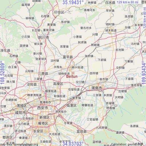
Beitun GPS coordinates[2]
34° 37' 3.684" North, 109° 13' 52.356" East
| Map corner | latitude | longitude |
|---|---|---|
| Upper-left | 35.19431°, | 108.52809° |
| Center: | 34.61769°, | 109.23121° |
| Lower-right: | 34.03703°, | 109.93434° |
| Map W x H: | 128.7×128.7 km | = 80×80mi |
| max Lat: | 53.31946° ⇑26.7% North |
| Beitun: | 34.61769° |
| min Lat: | ⇓73.3% South 18.22056° |
| min Long | Beitun | max Long |
| 75.07348° | 109.23121° | 134.28917° |
| W 24.8%⇐ | ⇒75.2% E |
Elevation
Elevation of Beitun is 378 m = 1240 ft, and this is 106.8 m = 350 ft below average elevation for this country.
| Max E: |
5622 m = 18445 ft | 31.9% |
| Avg. | 484.8 m = 1591 ft | |
| Beitun | 378 m = 1240 ft | |
Min E: |
-3 m = -10 ft | 68.1% |
See also: China elevation on elevation.city.
Geographical zone
Beitun is located in North temperate zone (between Tropic of Cancer and the Arctic Circle). Distance of this Northern Tropic circle is 1243.2 km =772.5 mi to South.| Distance of | km | miles | from Beitun |
|---|---|---|---|
| North Pole | 6157.9 | 3826.3 | to North |
| Arctic Circle | 3552 | 2207.1 | to North |
| Tropic Cancer | 1243.2 | 772.5 | to South |
| Equator | 3849.1 | 2391.7 | to South |


Nearby cities:
15 places around Beitun: (largest is in red/bold)
• Beixi
11.2 km =7 mi,  271°
271°
• Dacheng
10.1 km =6.3 mi,  298°
298°
• Dongshangguan
12.5 km =7.8 mi,  353°
353°
• Hezhai
13.7 km =8.5 mi,  144°
144°
• Jiaokou
9.6 km =6 mi, 141°
• Liyang
4.2 km =2.6 mi,  209°
209°
• Wutun
6.3 km =3.9 mi,  69°
69°
• Xiangqiao
12.4 km =7.7 mi,  91°
91°
• Xinshi
10 km =6.2 mi, 207°
• Xinxing
6.7 km =4.2 mi,  35°
35°
• Xumu
13.6 km =8.5 mi,  308°
308°
• Xuyang
8 km =5 mi, 270°
• Yanliang
4.6 km =2.9 mi,  357°
357°
• Yujin
11.5 km =7.1 mi,  173°
173°
• Zhenxing
6.7 km =4.2 mi,  328°
328°
Sources, notices
• [Note1] Compared only with cities in China existing in our database
• [Src1] Map data: © OpenStreetMap contributors (CC-BY-SA)
• [Src2] Other city data from geonames.org with taken over terms of usage.
• [Src3] Geographical zone / Annual Mean Temperature by Robert A. Rohde @ Wikipedia
