Yakeshi geodata
Yakeshi (Inner Mongolia) is a seat of a third-order administrative division; located in China in Asia/Shanghai (GMT+8) time zone. With population of 116,284 people, there are 374 cities with bigger population in this country. Compared to other cities in China, 99.3% of cities are located further ↓South; 86.4% of cities are located further ←West and 79.3% of cities have lower elevation than Yakeshi. Note1


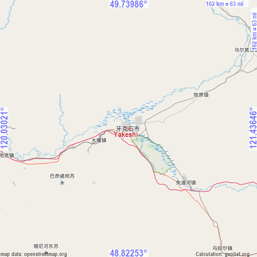
Yakeshi GPS coordinates[2]
49° 16' 59.988" North, 120° 43' 59.988" East
| Map corner | latitude | longitude |
|---|---|---|
| Upper-left | 49.73986°, | 120.03021° |
| Center: | 49.28333°, | 120.73333° |
| Lower-right: | 48.82253°, | 121.43646° |
| Map W x H: | 102×102 km | = 63.4×63.4mi |
| max Lat: | 53.31946° ⇑0.7% North |
| Yakeshi: | 49.28333° |
| min Lat: | ⇓99.3% South 18.22056° |
| min Long | Yakeshi | max Long |
| 75.07348° | 120.73333° | 134.28917° |
| W 86.4%⇐ | ⇒13.6% E |
Elevation
Elevation of Yakeshi is 661 m = 2169 ft, and this is 176.2 m = 578 ft above average elevation for this country.
| Max E: |
5622 m = 18445 ft | 20.7% |
| Yakeshi | 661 m 2169 ft | |
| Avg. | 484.8 m = 1591 ft | |
Min E: |
-3 m = -10 ft | 79.3% |
See also: Yakeshi elevation on elevation.city.
Geographical zone
Yakeshi is located in North temperate zone (between Tropic of Cancer and the Arctic Circle). Distance of this North polar circle is 1921.4 km =1193.9 mi to North.| Distance of | km | miles | from Yakeshi |
|---|---|---|---|
| North Pole | 4527.3 | 2813.1 | to North |
| Arctic Circle | 1921.4 | 1193.9 | to North |
| Tropic Cancer | 2873.9 | 1785.8 | to South |
| Equator | 5479.8 | 3405 | to South |


Nearby cities:
15 places around Yakeshi: (largest is in red/bold)
• Baorixile
69.1 km =42.9 mi,  275°
275°
• Bayan Tuohai
74.5 km =46.3 mi,  257°
257°
• Bayin Tala Dahan’er Minzu
79 km =49.1 mi,  247°
247°
• Fendou
70.6 km =43.9 mi, 262°
• Hailar
75.6 km =47 mi, 262°
• Hake
49.4 km =30.7 mi, 257°
• Jianshe
69.7 km =43.3 mi,  267°
267°
• Meitian
57.3 km =35.6 mi,  64°
64°
• Mianduhe
29.8 km =18.5 mi,  133°
133°
• Muyuan
31.2 km =19.4 mi,  65°
65°
• Wunu’er
59.5 km =37 mi,  141°
141°
• Wu’erqihan
57.6 km =35.8 mi, 55°
• Xie’ertala
59.8 km =37.2 mi, 271°
• Xingong
2.1 km =1.3 mi,  291°
291°
• Yuanlin
81.9 km =50.9 mi,  35°
35°
Sources, notices
• [Note1] Compared only with cities in China existing in our database
• [Src1] Map data: © OpenStreetMap contributors (CC-BY-SA)
• [Src2] Other city data from geonames.org with taken over terms of usage.
• [Src3] Geographical zone / Annual Mean Temperature by Robert A. Rohde @ Wikipedia
