Hake geodata
Hake (Inner Mongolia) is a seat of a fourth-order administrative division; located in China in Asia/Shanghai (GMT+8) time zone. In our database, there are 1268 cities with bigger population. Compared to other cities in China, 99.2% of cities are located further ↓South; 82.3% of cities are located further ←West and 78.2% of cities have lower elevation than Hake. Note1


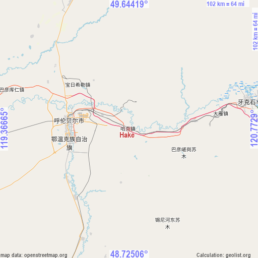
Hake GPS coordinates[2]
49° 11' 12.336" North, 120° 4' 11.172" East
| Map corner | latitude | longitude |
|---|---|---|
| Upper-left | 49.64419°, | 119.36665° |
| Center: | 49.18676°, | 120.06977° |
| Lower-right: | 48.72506°, | 120.7729° |
| Map W x H: | 102.2×102.2 km | = 63.5×63.5mi |
| max Lat: | 53.31946° ⇑0.8% North |
| Hake: | 49.18676° |
| min Lat: | ⇓99.2% South 18.22056° |
| min Long | Hake | max Long |
| 75.07348° | 120.06977° | 134.28917° |
| W 82.3%⇐ | ⇒17.7% E |
Elevation
Elevation of Hake is 621 m = 2037 ft, and this is 136.2 m = 447 ft above average elevation for this country.
| Max E: |
5622 m = 18445 ft | 21.8% |
| Hake | 621 m 2037 ft | |
| Avg. | 484.8 m = 1591 ft | |
Min E: |
-3 m = -10 ft | 78.2% |
See also: China elevation on elevation.city.
Geographical zone
Hake is located in North temperate zone (between Tropic of Cancer and the Arctic Circle). Distance of this North polar circle is 1932.1 km =1200.6 mi to North.| Distance of | km | miles | from Hake |
|---|---|---|---|
| North Pole | 4538 | 2819.8 | to North |
| Arctic Circle | 1932.1 | 1200.6 | to North |
| Tropic Cancer | 2863.1 | 1779 | to South |
| Equator | 5469.1 | 3398.3 | to South |


Nearby cities:
15 places around Hake: (largest is in red/bold)
• Baorixile
27.3 km =17 mi,  310°
310°
• Bayan Hure
53.1 km =33 mi, 310°
• Bayan Tuohai
25.2 km =15.7 mi,  256°
256°
• Bayin Tala Dahan’er Minzu
31.4 km =19.5 mi,  232°
232°
• Fendou
21.9 km =13.6 mi,  273°
273°
• Hailar
26.9 km =16.7 mi, 273°
• Jianshe
22.8 km =14.2 mi,  289°
289°
• Mianduhe
70.7 km =43.9 mi,  97°
97°
• Muyuan
80.1 km =49.8 mi,  72°
72°
• Wangong
85.7 km =53.3 mi, 270°
• Wunu’er
92.6 km =57.5 mi,  112°
112°
• Xie’ertala
17.3 km =10.7 mi,  317°
317°
• Xingong
47.6 km =29.6 mi,  76°
76°
• Yakeshi
49.4 km =30.7 mi, 77°
• Yiminhe
70.2 km =43.6 mi,  198°
198°
Sources, notices
• [Note1] Compared only with cities in China existing in our database
• [Src1] Map data: © OpenStreetMap contributors (CC-BY-SA)
• [Src2] Other city data from geonames.org with taken over terms of usage.
• [Src3] Geographical zone / Annual Mean Temperature by Robert A. Rohde @ Wikipedia
