Jianshe geodata
Jianshe (Inner Mongolia) is a seat of a fourth-order administrative division; located in China in Asia/Shanghai (GMT+8) time zone. In our database, there are 1268 cities with bigger population. Compared to other cities in China, 99.3% of cities are located further ↓South; 80.4% of cities are located further ←West and 77.9% of cities have lower elevation than Jianshe. Note1


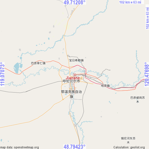
Jianshe GPS coordinates[2]
49° 15' 19.044" North, 119° 46' 25.86" East
| Map corner | latitude | longitude |
|---|---|---|
| Upper-left | 49.71208°, | 119.07073° |
| Center: | 49.25529°, | 119.77385° |
| Lower-right: | 48.79423°, | 120.47698° |
| Map W x H: | 102.1×102.1 km | = 63.4×63.4mi |
| max Lat: | 53.31946° ⇑0.7% North |
| Jianshe: | 49.25529° |
| min Lat: | ⇓99.3% South 18.22056° |
| min Long | Jianshe | max Long |
| 75.07348° | 119.77385° | 134.28917° |
| W 80.4%⇐ | ⇒19.6% E |
Elevation
Elevation of Jianshe is 610 m = 2001 ft, and this is 125.2 m = 411 ft above average elevation for this country.
| Max E: |
5622 m = 18445 ft | 22.1% |
| Jianshe | 610 m 2001 ft | |
| Avg. | 484.8 m = 1591 ft | |
Min E: |
-3 m = -10 ft | 77.9% |
See also: China elevation on elevation.city.
Geographical zone
Jianshe is located in North temperate zone (between Tropic of Cancer and the Arctic Circle). Distance of this North polar circle is 1924.5 km =1195.8 mi to North.| Distance of | km | miles | from Jianshe |
|---|---|---|---|
| North Pole | 4530.4 | 2815.1 | to North |
| Arctic Circle | 1924.5 | 1195.8 | to North |
| Tropic Cancer | 2870.8 | 1783.8 | to South |
| Equator | 5476.7 | 3403.1 | to South |


Nearby cities:
15 places around Jianshe: (largest is in red/bold)
• Baorixile
10.2 km =6.3 mi,  4°
4°
• Bayan Hure
33 km =20.5 mi,  325°
325°
• Bayan Tuohai
13.9 km =8.6 mi,  192°
192°
• Bayin Tala Dahan’er Minzu
26.8 km =16.7 mi, 187°
• Fendou
6.5 km =4 mi,  183°
183°
• Hailar
8.2 km =5.1 mi,  221°
221°
• Hake
22.8 km =14.2 mi,  109°
109°
• Mianduhe
93.2 km =57.9 mi,  100°
100°
• Muyuan
99.2 km =61.6 mi,  80°
80°
• Wangong
64.6 km =40.1 mi,  263°
263°
• Xie’ertala
11 km =6.8 mi,  62°
62°
• Xinbaoli Gedong
93.6 km =58.2 mi,  230°
230°
• Xingong
67.7 km =42.1 mi,  86°
86°
• Yakeshi
69.7 km =43.3 mi, 87°
• Yiminhe
74.3 km =46.2 mi, 180°
Sources, notices
• [Note1] Compared only with cities in China existing in our database
• [Src1] Map data: © OpenStreetMap contributors (CC-BY-SA)
• [Src2] Other city data from geonames.org with taken over terms of usage.
• [Src3] Geographical zone / Annual Mean Temperature by Robert A. Rohde @ Wikipedia
