Yagou geodata
Yagou (Heilongjiang) is a seat of a fourth-order administrative division; located in China in Asia/Shanghai (GMT+8) time zone. In our database, there are 1268 cities with bigger population. Compared to other cities in China, 94.3% of cities are located further ↓South; 96.8% of cities are located further ←West and 50.2% of cities have higher elevation than Yagou. Note1


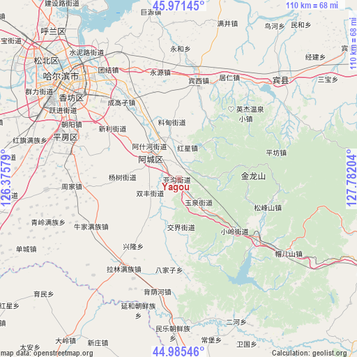
Yagou GPS coordinates[2]
45° 28' 50.196" North, 127° 4' 44.076" East
| Map corner | latitude | longitude |
|---|---|---|
| Upper-left | 45.97145°, | 126.37579° |
| Center: | 45.48061°, | 127.07891° |
| Lower-right: | 44.98546°, | 127.78204° |
| Map W x H: | 109.6×109.6 km | = 68.1×68.1mi |
| max Lat: | 53.31946° ⇑5.7% North |
| Yagou: | 45.48061° |
| min Lat: | ⇓94.3% South 18.22056° |
| min Long | Yagou | max Long |
| 75.07348° | 127.07891° | 134.28917° |
| W 96.8%⇐ | ⇒3.2% E |
Elevation
Elevation of Yagou is 163 m = 535 ft, and this is 321.8 m = 1056 ft below average elevation for this country.
| Max E: |
5622 m = 18445 ft | 50.2% |
| Avg. | 484.8 m = 1591 ft | |
| Yagou | 163 m = 535 ft | |
Min E: |
-3 m = -10 ft | 49.8% |
See also: China elevation on elevation.city.
Geographical zone
Yagou is located in North temperate zone (between Tropic of Cancer and the Arctic Circle). Distance of this North polar circle is 2344.2 km =1456.6 mi to North.| Distance of | km | miles | from Yagou |
|---|---|---|---|
| North Pole | 4950.1 | 3075.8 | to North |
| Arctic Circle | 2344.2 | 1456.6 | to North |
| Tropic Cancer | 2451.1 | 1523 | to South |
| Equator | 5057 | 3142.3 | to South |


Nearby cities:
15 places around Yagou: (largest is in red/bold)
• Acheng
10.7 km =6.6 mi,  312°
312°
• Ashihe
10.2 km =6.3 mi, 306°
• Bajiazi
28.1 km =17.5 mi,  185°
185°
• Binxi
30.4 km =18.9 mi,  11°
11°
• Daling
3.9 km =2.4 mi,  42°
42°
• Feiketu
30.1 km =18.7 mi, 9°
• Hongxing
9.8 km =6.1 mi, 14°
• Jiaojie
14.8 km =9.2 mi,  177°
177°
• Liaodian
17 km =10.6 mi,  353°
353°
• Sheli
15 km =9.3 mi, 308°
• Shuangfeng
9.8 km =6.1 mi,  243°
243°
• Songfengshan
28.8 km =17.9 mi,  107°
107°
• Xiaoling
23.9 km =14.9 mi,  132°
132°
• Xinglong
24.5 km =15.2 mi,  214°
214°
• Yuquan
10 km =6.2 mi,  141°
141°
Sources, notices
• [Note1] Compared only with cities in China existing in our database
• [Src1] Map data: © OpenStreetMap contributors (CC-BY-SA)
• [Src2] Other city data from geonames.org with taken over terms of usage.
• [Src3] Geographical zone / Annual Mean Temperature by Robert A. Rohde @ Wikipedia
