Qinlao geodata
Qinlao (Heilongjiang) is a seat of a fourth-order administrative division; located in China in Asia/Shanghai (GMT+8) time zone. In our database, there are 1268 cities with bigger population. Compared to other cities in China, 97% of cities are located further ↓South; 97.7% of cities are located further ←West and 53.4% of cities have lower elevation than Qinlao. Note1


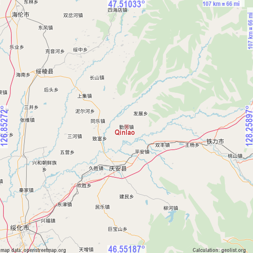
Qinlao GPS coordinates[2]
47° 1' 59.7" North, 127° 33' 21.024" East
| Map corner | latitude | longitude |
|---|---|---|
| Upper-left | 47.51033°, | 126.85272° |
| Center: | 47.03325°, | 127.55584° |
| Lower-right: | 46.55187°, | 128.25897° |
| Map W x H: | 106.6×106.6 km | = 66.2×66.2mi |
| max Lat: | 53.31946° ⇑3% North |
| Qinlao: | 47.03325° |
| min Lat: | ⇓97% South 18.22056° |
| min Long | Qinlao | max Long |
| 75.07348° | 127.55584° | 134.28917° |
| W 97.7%⇐ | ⇒2.3% E |
Elevation
Elevation of Qinlao is 192 m = 630 ft, and this is 292.8 m = 961 ft below average elevation for this country.
| Max E: |
5622 m = 18445 ft | 46.6% |
| Avg. | 484.8 m = 1591 ft | |
| Qinlao | 192 m = 630 ft | |
Min E: |
-3 m = -10 ft | 53.4% |
See also: China elevation on elevation.city.
Geographical zone
Qinlao is located in North temperate zone (between Tropic of Cancer and the Arctic Circle). Distance of this North polar circle is 2171.6 km =1349.4 mi to North.| Distance of | km | miles | from Qinlao |
|---|---|---|---|
| North Pole | 4777.5 | 2968.6 | to North |
| Arctic Circle | 2171.6 | 1349.4 | to North |
| Tropic Cancer | 2623.7 | 1630.3 | to South |
| Equator | 5229.6 | 3249.5 | to South |


Nearby cities:
15 places around Qinlao: (largest is in red/bold)
• Changshan
24.2 km =15 mi,  327°
327°
• Fazhan
8.4 km =5.2 mi,  45°
45°
• Fengshou
17.7 km =11 mi,  173°
173°
• Jiusheng
21.6 km =13.4 mi,  217°
217°
• Liangli
24.5 km =15.2 mi,  140°
140°
• Ping’an
12.1 km =7.5 mi,  148°
148°
• Qing’an
17.8 km =11.1 mi,  193°
193°
• Sanhe
21 km =13 mi,  260°
260°
• Shangji
22.1 km =13.7 mi,  306°
306°
• Shuangfeng
16.6 km =10.3 mi,  116°
116°
• Tongle
12.5 km =7.8 mi,  281°
281°
• Wangyang
28.6 km =17.8 mi,  104°
104°
• Weiguo
24.7 km =15.3 mi,  128°
128°
• Wuying
27 km =16.8 mi,  246°
246°
• Zhifu
12.3 km =7.6 mi, 247°
Sources, notices
• [Note1] Compared only with cities in China existing in our database
• [Src1] Map data: © OpenStreetMap contributors (CC-BY-SA)
• [Src2] Other city data from geonames.org with taken over terms of usage.
• [Src3] Geographical zone / Annual Mean Temperature by Robert A. Rohde @ Wikipedia
