Wangyang geodata
Wangyang (Heilongjiang) is a seat of a fourth-order administrative division; located in China in Asia/Shanghai (GMT+8) time zone. In our database, there are 1268 cities with bigger population. Compared to other cities in China, 96.9% of cities are located further ↓South; 97.9% of cities are located further ←West and 55.7% of cities have lower elevation than Wangyang. Note1


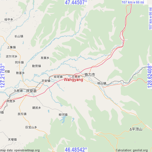
Wangyang GPS coordinates[2]
46° 58' 2.64" North, 127° 55' 15.42" East
| Map corner | latitude | longitude |
|---|---|---|
| Upper-left | 47.44507°, | 127.21783° |
| Center: | 46.9674°, | 127.92095° |
| Lower-right: | 46.48542°, | 128.62408° |
| Map W x H: | 106.7×106.7 km | = 66.3×66.3mi |
| max Lat: | 53.31946° ⇑3.1% North |
| Wangyang: | 46.9674° |
| min Lat: | ⇓96.9% South 18.22056° |
| min Long | Wangyang | max Long |
| 75.07348° | 127.92095° | 134.28917° |
| W 97.9%⇐ | ⇒2.1% E |
Elevation
Elevation of Wangyang is 213 m = 699 ft, and this is 271.8 m = 892 ft below average elevation for this country.
| Max E: |
5622 m = 18445 ft | 44.3% |
| Avg. | 484.8 m = 1591 ft | |
| Wangyang | 213 m = 699 ft | |
Min E: |
-3 m = -10 ft | 55.7% |
See also: China elevation on elevation.city.
Geographical zone
Wangyang is located in North temperate zone (between Tropic of Cancer and the Arctic Circle). Distance of this North polar circle is 2178.9 km =1353.9 mi to North.| Distance of | km | miles | from Wangyang |
|---|---|---|---|
| North Pole | 4784.8 | 2973.1 | to North |
| Arctic Circle | 2178.9 | 1353.9 | to North |
| Tropic Cancer | 2616.4 | 1625.8 | to South |
| Equator | 5222.3 | 3245 | to South |


Nearby cities:
15 places around Wangyang: (largest is in red/bold)
• Fazhan
25.4 km =15.8 mi,  301°
301°
• Fengshou
27.7 km =17.2 mi,  248°
248°
• Gongnong
5.8 km =3.6 mi,  66°
66°
• Jianmin
35.6 km =22.1 mi,  231°
231°
• Liangli
16.6 km =10.3 mi, 226°
• Nianfeng
7.7 km =4.8 mi,  93°
93°
• Ping’an
21.5 km =13.4 mi,  261°
261°
• Qing’an
33.5 km =20.8 mi, 252°
• Qinlao
28.6 km =17.8 mi,  284°
284°
• Shenshu
38 km =23.6 mi, 94°
• Shuangfeng
12.8 km =8 mi,  269°
269°
• Taoshan
19.2 km =11.9 mi,  104°
104°
• Tieli
9.5 km =5.9 mi,  81°
81°
• Weiguo
11.7 km =7.3 mi, 225°
• Xinsheng
28.3 km =17.6 mi,  215°
215°
Sources, notices
• [Note1] Compared only with cities in China existing in our database
• [Src1] Map data: © OpenStreetMap contributors (CC-BY-SA)
• [Src2] Other city data from geonames.org with taken over terms of usage.
• [Src3] Geographical zone / Annual Mean Temperature by Robert A. Rohde @ Wikipedia
