Langxiang geodata
Langxiang (Heilongjiang) is a seat of a fourth-order administrative division; located in China in Asia/Shanghai (GMT+8) time zone. With population of 57,318 people, there are 766 cities with bigger population in this country. Compared to other cities in China, 96.9% of cities are located further ↓South; 98.3% of cities are located further ←West and 60.5% of cities have lower elevation than Langxiang. Note1


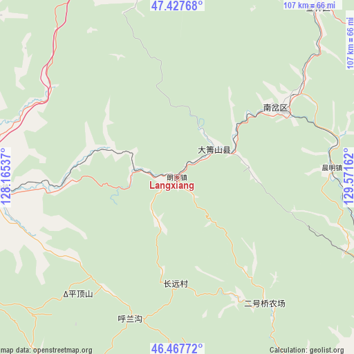
Langxiang GPS coordinates[2]
46° 56' 59.46" North, 128° 52' 6.564" East
| Map corner | latitude | longitude |
|---|---|---|
| Upper-left | 47.42768°, | 128.16537° |
| Center: | 46.94985°, | 128.86849° |
| Lower-right: | 46.46772°, | 129.57162° |
| Map W x H: | 106.7×106.7 km | = 66.3×66.3mi |
| max Lat: | 53.31946° ⇑3.1% North |
| Langxiang: | 46.94985° |
| min Lat: | ⇓96.9% South 18.22056° |
| min Long | Langxiang | max Long |
| 75.07348° | 128.86849° | 134.28917° |
| W 98.3%⇐ | ⇒1.7% E |
Elevation
Elevation of Langxiang is 266 m = 873 ft, and this is 218.8 m = 718 ft below average elevation for this country.
| Max E: |
5622 m = 18445 ft | 39.5% |
| Avg. | 484.8 m = 1591 ft | |
| Langxiang | 266 m = 873 ft | |
Min E: |
-3 m = -10 ft | 60.5% |
See also: Langxiang elevation on elevation.city.
Geographical zone
Langxiang is located in North temperate zone (between Tropic of Cancer and the Arctic Circle). Distance of this North polar circle is 2180.8 km =1355.1 mi to North.| Distance of | km | miles | from Langxiang |
|---|---|---|---|
| North Pole | 4786.7 | 2974.3 | to North |
| Arctic Circle | 2180.8 | 1355.1 | to North |
| Tropic Cancer | 2614.4 | 1624.5 | to South |
| Equator | 5220.3 | 3243.7 | to South |


Nearby cities:
15 places around Langxiang: (largest is in red/bold)
• Chenming
46.7 km =29 mi,  86°
86°
• Dailing
14.1 km =8.8 mi,  54°
54°
• Fendou
66.3 km =41.2 mi,  39°
39°
• Gongnong
66.7 km =41.4 mi,  273°
273°
• Haolianghe
63 km =39.1 mi,  113°
113°
• Lianhe
36.9 km =22.9 mi,  56°
56°
• Nianfeng
64.2 km =39.9 mi, 271°
• Shenshu
34.1 km =21.2 mi, 268°
• Tangwang
76.6 km =47.6 mi,  119°
119°
• Taoshan
53.5 km =33.2 mi, 266°
• Tieli
62.6 km =38.9 mi, 273°
• Wangyang
71.9 km =44.7 mi, 271°
• Xianglan
75 km =46.6 mi, 116°
• Xilin
67.1 km =41.7 mi,  29°
29°
• Yingchun
35.2 km =21.9 mi, 51°
Sources, notices
• [Note1] Compared only with cities in China existing in our database
• [Src1] Map data: © OpenStreetMap contributors (CC-BY-SA)
• [Src2] Other city data from geonames.org with taken over terms of usage.
• [Src3] Geographical zone / Annual Mean Temperature by Robert A. Rohde @ Wikipedia
